News   GLOBAL  |  Apr 02, 2020
 8.8K     0 
News   GLOBAL  |  Apr 01, 2020
 40K     0 
News   GLOBAL  |  Apr 01, 2020
 5K     0 

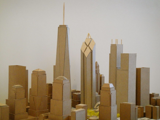
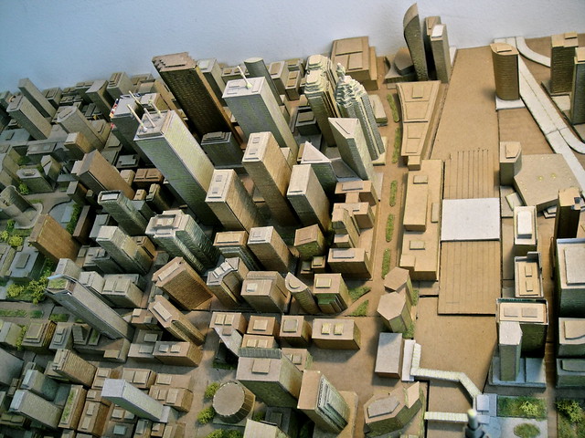
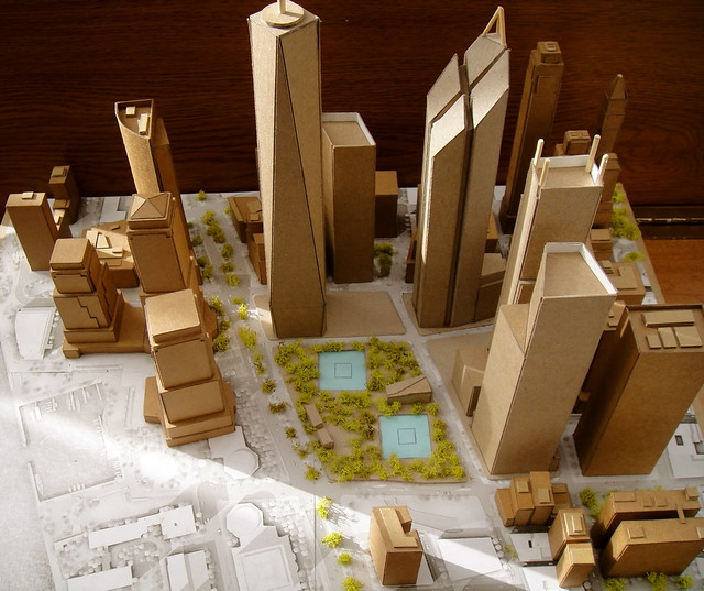
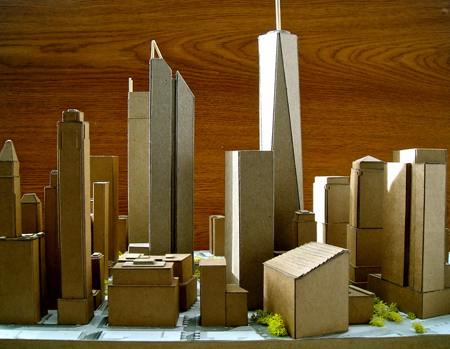
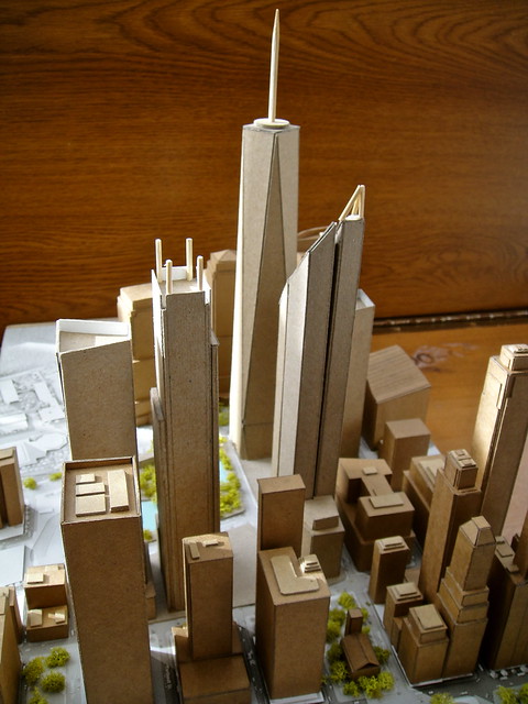
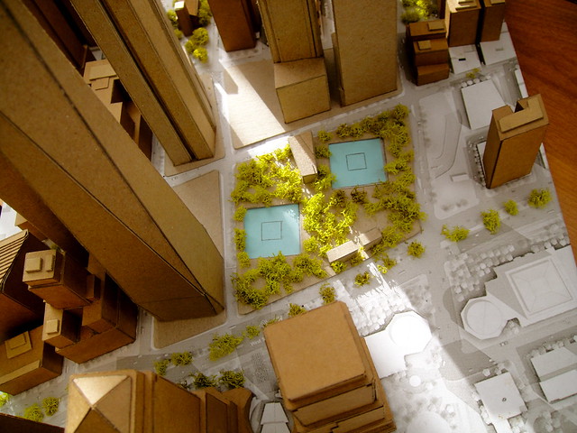
Forgive me for going way off topic with this world trade center model, but i need a place to dump them till i get a thread started on Skyscraperpage.

5691303201_582840a23e_z.jpg


5691876734_9b5c687064_z.jpg


5691877558_330d321b92_z.jpg


5691878432_9c101cc209_z.jpg


5691307301_c18dbb8b8c_z.jpg


5691880280_cc3921c07d_z.jpg


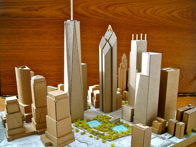
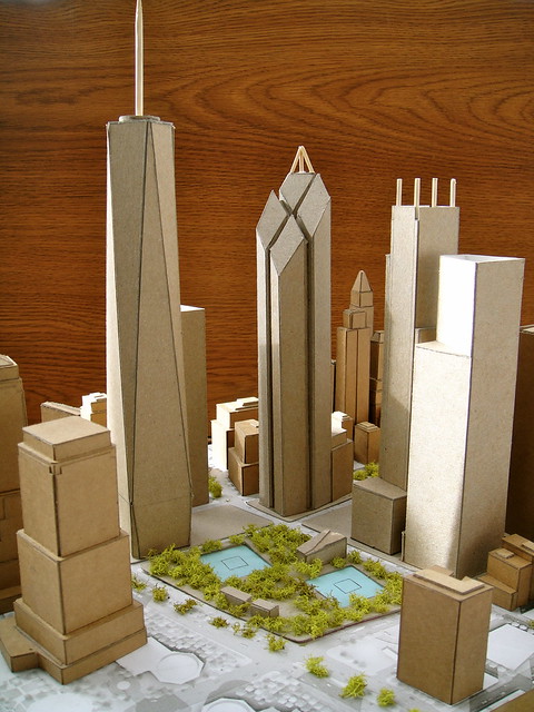
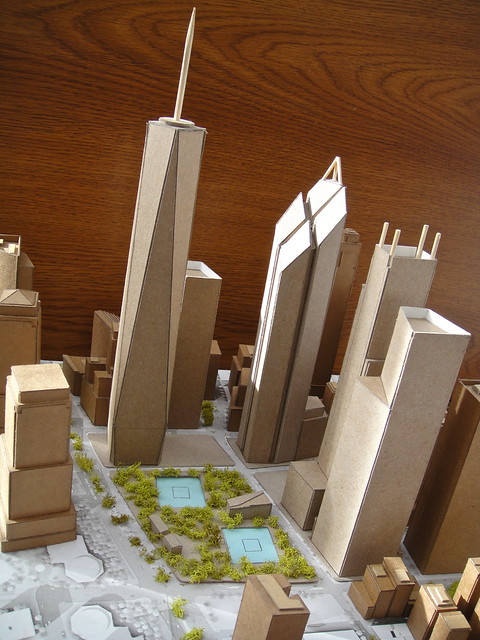
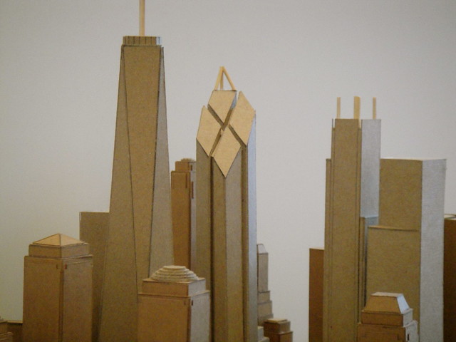
And, of course,.... the Wedge of Light!!!!

5691875768_119a855c54_z.jpg


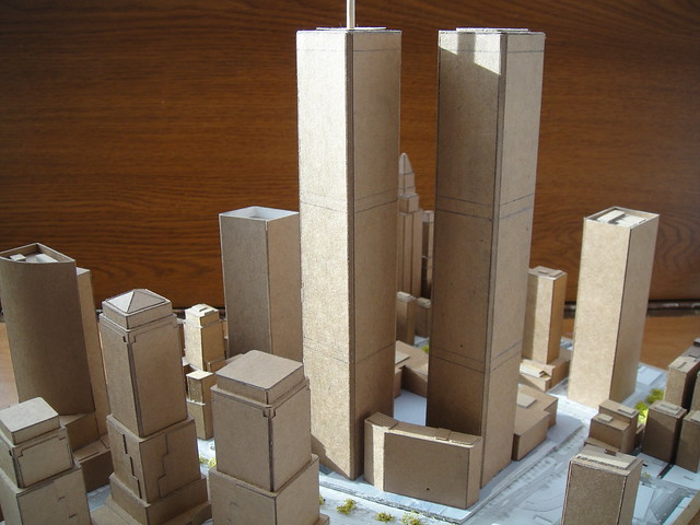
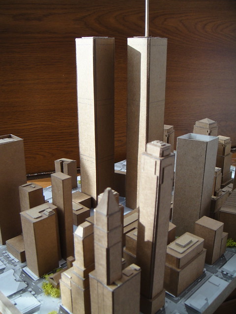
And I couldn't leave out the former World Trade Center.

5691881940_90ae8887b8_z.jpg


5691881086_8bbab07164_z.jpg


5691302153_0fc9c94d4b_z.jpg


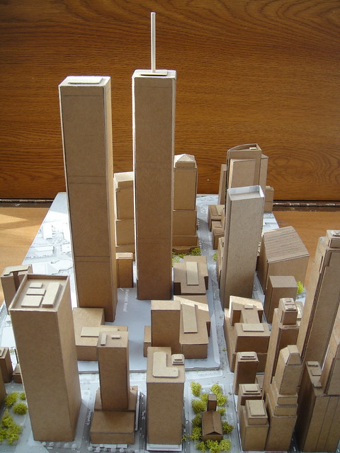
I'll remove these photos from this thread once I start up a World Trade Center model thread at Skyscraperpage.

Steveve: Neat NYC WTC Models along with the models of the new 1 WTC along with the memorial...

This is really an interesting rendering in both cases that took much research and careful work...

I really like it...and your Toronto model is quite neat also!

LI MIKE
 
Great job, looks fantastic.
Have you thought of textures for the buildings?
Using the "unfold" plugin, and Sketchup, you could print out "skins" for your buildings.
Wyliepoons has done an amazing job of modeling most of Toronto.
You could ask him if you could use his work to bring his Sketchup models to life in real 3D!
 
ty for all the comments, and srry for not updating the thread, building has come to a stand still for a while, been busy,
and regarding skins, it's cool, but probably too much work, if i were to do skins, they'd be for individual models lol!
 
Dude! Don't remove the NYC models from here They're Awesome!! Wow!
(same w/ the TO ones obvi)
 
okay, you guys wanted more WTC photos.
this project wrapped up about 3 weeks ago, I'd like to expand it, but the map i'm using as a template doesn't go that far,

I used this map:
*If anyone knows where to find a larger (more expansive, geographically/area wise) please post a link!
199000-hr.jpg


5794584070_83fb924f59_z.jpg


5794024219_255b0cef36_z.jpg
 
Your first post is to criticize the amazing work a 16(?) year old has done in creating a detailed 3D model of the city?

And I hope you are being sarcastic by criticizing him for not creating models of buildings that aren't even designed yet. Because if you were serious, then that would be, well, embarrassing...
 
Your missing alot of stuff like 45 Bay st, King and Charlotte and 40 Scott st.:confused:

it's either that full renders have not been released (things could still change), or it's cause i haven't been working on this model for the past month and a half,

and Bruvyman, i don't think he's trolling, it's an honest question :)
 
I'm looking at building an improved, more detailed financial district model, If anyone knows where to find a basic map of the downtown core (without any fancy labels and what not.... street labels are fine), it would be great. I'm thinking of printing out a large version, and using it as a guideline for the model... I've considered using google maps, but they have some weird geography/terrain on it, so it will be hard to use...
In the mean time.... i will search....

steveve :)
 
You can buy property data maps from the city of Toronto. It costs money but the outlines of all buildings are already there. I think you can customize what labels exist. I get them because they have property addresses and all structures, lane-ways etc. on them.
 
You can buy property data maps from the city of Toronto. It costs money but the outlines of all buildings are already there. I think you can customize what labels exist. I get them because they have property addresses and all structures, lane-ways etc. on them.

interesting.... i'm looking into it right now, all very complex stuff.... can't really find what they look like though, :confused:
 

Back
Top