|
|
|


You are using an out of date browser. It may not display this or other websites correctly.
You should upgrade or use an alternative browser.
You should upgrade or use an alternative browser.
- Thread starter Daveography
- Start date
The_Cat
Senior Member
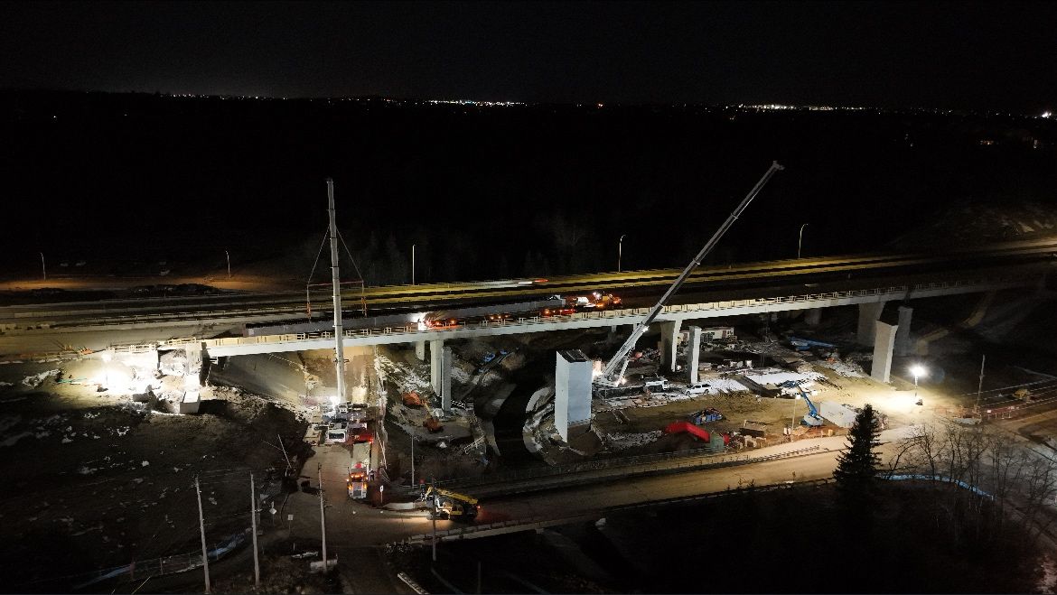
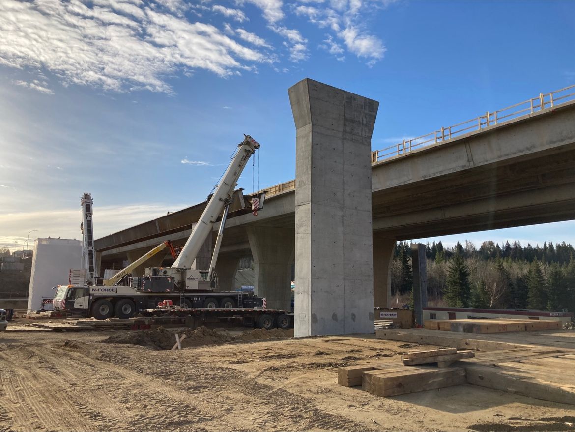
Looks like some construction on the south side of the Whitemud bridge.
Windermere
Active Member
Changes to Pathway Plans
Based on technical requirements, safety considerations, and feedback from community engagement in early 2022, the shared pathway will now be separate from the Terwillegar Drive roadway and interchange.
A new pedestrian bridge will be constructed over Anthony Henday Drive between Terwillegar Drive and Rabbit Hill Road. This bridge will connect the recently completed Stage One shared pathway with Ambleside, east of Currents of Windermere. This is a change from the initial design shared in 2022.

Terwillegar Drive Expansion - Stage Three | City of Edmonton
Stage Three includes road widening, Terwillegar Drive and Anthony Henday Drive Interchange upgrades, dedicated transit lanes and a shared-use pathway.
MacLac
Senior Member
"......and the interchange at Terwillegar Drive/170 Street will be improved to better handle traffic flow."Terwillegar Drive Expansion - Stage Three | City of Edmonton
Stage Three includes road widening, Terwillegar Drive and Anthony Henday Drive Interchange upgrades, dedicated transit lanes and a shared-use pathway.www.edmonton.ca
Huh? Interchange at Terwillegar and 170st? That is merely an intersection.......no interchange here....
thommyjo
Senior Member
Struggling to understand this new bridge. Is this what they mean?
If so, what a horribly inefficient detour for getting to anything along terwillegar/170st.
Easily a 10-15min biking detour if you were try to access say upper windemere from NW of the henday here. If they’re building a fully separated path, why not keep it at least close to the alignment??

If so, what a horribly inefficient detour for getting to anything along terwillegar/170st.
Easily a 10-15min biking detour if you were try to access say upper windemere from NW of the henday here. If they’re building a fully separated path, why not keep it at least close to the alignment??
Windermere
Active Member
The path follows 156 south of 23rd, not Terwillegar.Struggling to understand this new bridge. Is this what they mean?
If so, what a horribly inefficient detour for getting to anything along terwillegar/170st.
Easily a 10-15min biking detour if you were try to access say upper windemere from NW of the henday here. If they’re building a fully separated path, why not keep it at least close to the alignment??
View attachment 565950
I think it will be like this:
northlands
Senior Member
Was just about to draw this also, except I think they'll run the bridge a little more SE and have it closer to the Ambleside roundabout. But overall, despite there being nice MUPs throughout Ambleside, they've built it without any real consideration for an easy MUP connector into the neighbourhood from the east.The path follows 156 south of 23rd, not Terwillegar.
I think it will be like this:
View attachment 565961
Be nice if they could provide some high level conceptual drawings--detailed design was supposed to have been complete 6+ months ago. Why the secrecy?
thommyjo
Senior Member
This is pretty disappointing. Major detour for those trying to get west of 170th street/terwillegar from south of henday to north.Was just about to draw this also, except I think they'll run the bridge a little more SE and have it closer to the Ambleside roundabout. But overall, despite there being nice MUPs throughout Ambleside, they've built it without any real consideration for an easy MUP connector into the neighbourhood from the east.
Be nice if they could provide some high level conceptual drawings--detailed design was supposed to have been complete 6+ months ago. Why the secrecy?
The original crossings were super dangerous too. But this is pretty inconvenient…
Rabbit hill road already connects here with a MUP. this might be 3mins more direct. But likely 10-15mins detour vs a terwillegar alignment…
mcr
Active Member
Looks like the shared use path will hug the new auto bridge to me, plus have a connection from existing onto 156 St.

From Stage 3 overview plan: https://www.edmonton.ca/sites/default/files/public-files/TDS3-Overview.pdf?cb=1716497592 / https://www.edmonton.ca/projects_plans/terwillegar_drive/stage-three
From Stage 3 overview plan: https://www.edmonton.ca/sites/default/files/public-files/TDS3-Overview.pdf?cb=1716497592 / https://www.edmonton.ca/projects_plans/terwillegar_drive/stage-three
thommyjo
Senior Member
I think this is the original design. Which was also bad cause you basically had a MUP crossing 5 roads. All of which have traffic travelling 80+ km/hr and most of them involving turns where blind spots from car window frames are worse and when people are looking the opposite of their turn (look left while turning right is a classic kill move).Looks like the shared use path will hug the new auto bridge to me, plus have a connection from existing onto 156 St.
View attachment 566176
From Stage 3 overview plan: https://www.edmonton.ca/sites/default/files/public-files/TDS3-Overview.pdf?cb=1716497592 / https://www.edmonton.ca/projects_plans/terwillegar_drive/stage-three
So changing this is good. But moving the alignment so far away is not good because it now dramatically changes the utility and efficiency of this route/biking. And essentially leaves west terwillegar and windemere not served, while doubling up the rabbit hill road service for terwillegar towne/chapelle.
Airboy
Senior Member
Now when they add the next bridge can they just maybe carry Terwilliger due south to Highway 19.
mcr
Active Member
Hmm, yeah looks like you're right, the PDF does seem outdated based on that.I think this is the original design. Which was also bad cause you basically had a MUP crossing 5 roads. All of which have traffic travelling 80+ km/hr and most of them involving turns where blind spots from car window frames are worse and when people are looking the opposite of their turn (look left while turning right is a classic kill move).
So changing this is good. But moving the alignment so far away is not good because it now dramatically changes the utility and efficiency of this route/biking. And essentially leaves west terwillegar and windemere not served, while doubling up the rabbit hill road service for terwillegar towne/chapelle.
View attachment 566177
Windermere
Active Member
Neighborhoods west of Terwillegar will eventually have the path under the Henday bridge over the river.I think this is the original design. Which was also bad cause you basically had a MUP crossing 5 roads. All of which have traffic travelling 80+ km/hr and most of them involving turns where blind spots from car window frames are worse and when people are looking the opposite of their turn (look left while turning right is a classic kill move).
So changing this is good. But moving the alignment so far away is not good because it now dramatically changes the utility and efficiency of this route/biking. And essentially leaves west terwillegar and windemere not served, while doubling up the rabbit hill road service for terwillegar towne/chapelle.
View attachment 566177
thommyjo
Senior Member
What’s the plan for that one?Neighborhoods west of Terwillegar will eventually have the path under the Henday bridge over the river.
Airboy
Senior Member
There is a path that could be developed fairly quickly. An old road (23ave) runs a portion of the way down and access is there to the bottom into the flats. It would not be hard to bring it North to meet the henday bridge. And it would not screw up any of the mountain bike trails in that area.