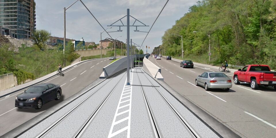
This image represents the west portal of the Eglinton Crosstown, west of Leslie Street.
What I propose is that the cars using the Eglinton eastbound left turn lane be on the north side of the right-of-way. They move into that left turn lane before the Brentcliffe portal and then stay on the north side of the right-of-way until they can make their left turn onto northbound Leslie. The left turn lane shown below would then be shifted right to where they show "landscaped area", just to left of the westbound lanes.
Instead of having the southbound Leslie turning directly into the eastbound Eglinton lanes,
they'll remain on the north side of the right-of-way until the east portal before merging into the eastbound Eglinton traffic.
The stops for Leslie could then be positioned westerly into the current intersection. A pedestrian signal may be a cheap way cross Eglinton eastbound traffic at that point. Regular traffic and pedestrian signals would be used to cross Eglinton westbound traffic.