Many thanks to @sunnyraytoronto for linking that string! https://urbantoronto.ca/forum/threads/leaside-bridge.19243/page-2 Even though it's 'a bridge too far', some of the comments at the string are excellent, but here's the most shocking point to be made: (the now projected passenger numbers per work week day)

diminutive said:
The DRTES put peak demand in 2030 at 15k pphpd. That's easily met by ICTS scaled vehicles traveling at 90s headways.

Reintroducing LIMs probably wouldn't be a good idea, but any new route should designed to realize all of the cost savings possible. Things like running through a single tunnel, or tighter turn radii and grade allowances.

Also, economy of scale in rolling stock seems nonexistant in Toronto.
I agree with this.

Currently, it seems we use this logic. DRL is needed. It should be subway. The way Toronto and TTC build subways, the cost is $450/km.

We have to include the ability to actually collect the money to get the project to actually proceed. The above scenario will have maybe a 25% chance of being started within 10 years. But if we cut costs by one of several means, we could get a cost of $200M/km and still have a grade-separated line. Sure the capacity is only 20 to 25k instead of 30 to 35k, but it still meets our needs. Also, the probability of recieving enough support for the project to actually begin within 10 years may increase to 75%.

Instead of trying to get a home run, we should settle for a double.
Verster has stated "400,000 per work-week day" at least twice here:

That figure, and that's just for up to Eglinton, almost matches the Yonge St portion of Line 1. I don't have a reference handy for that right now, but looked it up a few days back.

What that makes clear to me is that this must be built *heavier* than conventional subway, not lighter. This is RER capacity level. And London, Paris and other cities are building newer tech mainline trains that can run in subway size tunnel, run ATO, max speed up to 100 mph and are in operation as I type.

Ford and Fedeli have no idea of what they've released. Verster's comment can't be back-pedalled.
 
That figure, and that's just for up to Eglinton, almost matches the Yonge St portion of Line 1. I don't have a reference handy for that right now, but looked it up a few days back.
https://www.ttc.ca/PDF/Transit_Planning/Subway ridership 2016.pdf
I found 2016 stats, Union to Wellesley is about 370k passengers using those stations. Bloor station is 200k on it's own - separate from the 180 using the Yonge station.
What that makes clear to me is that this must be built *heavier* than conventional subway, not lighter. This is RER capacity level. And London, Paris and other cities are building newer tech mainline trains that can run in subway size tunnel, run ATO, max speed up to 100 mph and are in operation as I type.

Ford and Fedeli have no idea of what they've released. Verster's comment can't be back-pedalled.
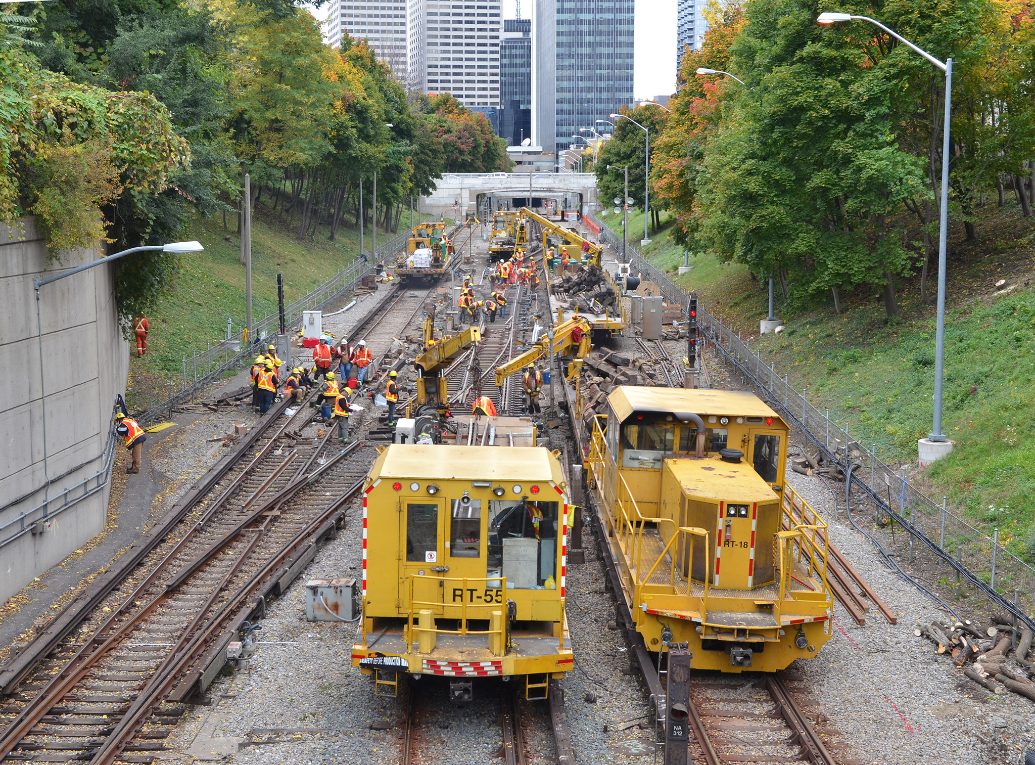
It's always a trade-off. What's better, a shorter, high capacity line, or a longer line that might fill up.
When I look at the University leg of YUS, I imagine that if it went up Dufferin, then that leg would have probably only went to Eglinton (instead of Yorkdale) in the 1970's, and to Yordale this decade. It was just the fact that it was built cheaper that is was extended as far as it did.
The key is, there needs to be a potential plan for another DRL when this one fills up. From a redundancy point of view, you are always better building 2 transit lines with 25k capacity than 1 line with 40k.
Here, I think the solution as the Lakeshore LRT lines that would go up Bay all the way to ~Davenport.
The 'overlooked' Lakeshore LRTs. Thoroughly agreed on that. It would just as easily by-pass Union as feed it if need be, another discussion. Agreed also on the pressure being put on the RL to be what Verster is now calling it: (gist, refer to Metrolinx link I posted above @ 12:00 mins in) "It will divert around 9,000 passengers any peak hour away from Line 1...This is not a Relief Line as such, this is a line in its own right".

But here's the catch to 'spreading the load' with two more modest lines instead of a larger one, and that catch isn't just cost, it's time:
Construction on Ontario Line not expected to begin until late 2020, province says

Colin D'Mello, Queen’s Park Bureau Chief, CTV
Published Wednesday, April 17, 2019 9:30AM EDT
[...]
University of Toronto professor Matti Siemiatycki, who holds a PhD in urban planning, said the province's plans are “conceivable” but cautioned that the government would need to be disciplined and motivated to move the project forward.

"The issue in Ontario is the money," Siemiatycki told CTV News Toronto.

"We have had a very hard time agreeing politically and we have a very hard time with the funding."

The province has committed $11.2 billion of the $28.5 billion required to build four transit lines – the Ontario Line, a three-stop extension of the Scarborough subway, the Yonge line extension and Eglinton Crosstown west underground expansion to Toronto Pearson International Airport.

Siemiatycki said he believes the province has a pathway to completing the project by 2027 if it breaks down the project into at least three phases.

The first phase would involve building the "spine" of the line – from Pape Station southwest to Osgoode Station – which has already undergone advanced planning.

The second phase, Siemiatycki believes, would be the construction of a rougly 500 meter long bridge over the Don River to the Ontario Science Centre, which would cross a valley below.

Siemiatycki anticipates the southern extension to Ontario Place would be the final part of the project because there has been little to no design work done so far.

"There is a squiggly line on a map," Siemiatycki said.

Yurek acknowledged that the plans for the downtown relief line, which is currently being designed by the City of Toronto, TTC and Metrolinx would still have to be uploaded to the province before work could get underway.

“The key is to ensure our talks with the city of Toronto continue so that we can work together on adopting their plans and what they put into it to build this Ontario Line,” he said.

The relief line is currently in the preliminary stages with the design 15 to 30 per cent complete. City council is awaiting an update expected this spring.

The relief line southbound, from Pape to Osgoode stations, was projected to be completed by 2029.
https://toronto.ctvnews.ca/construc...begin-until-late-2020-province-says-1.4383646

Some of the claims are suspect, as is the case for any stories on the subject. This one alludes to a bridge at the Science Centre but not near Millwood. At this rate, even getting one line built appears iffy. The missing factor is a consortium stepping up to state "We'll build it, and here are the terms". And for that to happen, it will have to be 'the One Ring that binds them all' to allow a project of size to make a justifiable business case to attract majority private investment.

I just don't see any impetus for this to be built by Gov't otherwise.
 

Attachments

  • 1555717175723.png
    1555717175723.png
    383.7 KB · Views: 396
Last edited:
Some of the claims are suspect, as is the case for any stories on the subject. This one alludes to a bridge at the Science Centre but not near Millwood. At this rate, even getting one line built appears iffy. The missing factor is a consortium stepping up to state "We'll build it, and here are the terms". And for that to happen, it will have to be 'the One Ring that binds them all' to allow a project of size to make a justifiable business case to attract majority private investment.
This is not a quote from an expert, but the reporter trying to summarize. It is likely just the reporter not being accurate enough. I could seen another bridge over the West Branch of the Don (under or beside Overlea), but that is more like 200m long and not as high level.
 
 
^ Excellent heads up. I'd missed that one from Lorinc. He makes many excellent points.

This one rings the bell:
25. How will the Metrolinx “market-driven approach” apply to these projects? Have any private sector partners been engaged on any of these projects to date?
I would say it is axiomatic that Ford and the officials assigned to the subway upload special ops team led by Michael Lindsay had several fortuitous meetings with whichever rolling stock multinational – a.k.a. “private sector partner” — is marketing the light-weight, driverless vehicles that caused the premier’s jaw to drop, and which will run along the Ontario Line. Keep an eagle eye trained on the eventual RFP for that equipment, and let the connecting of the dots begin.
The really big question is not 'if' a "rolling stock multinational" has made a presentation, it's doubtless, not that the F Boys could ever understand all the big words (those with more than four letters), but if that multinational has already assembled a consortium and funding from the InfraBank to the majority level to dictate sole sourcing of that rolling stock. With that would come a quid pro quo of enlarging facilities in Ontario to assemble units built overseas. (Frankly I think that would be a mistake in terms of engineering finesse, but a necessary political sop)(edit to add: It's always much more reliable to have the factory that built the 'kits' assemble and test them. Witness the BBD fiascos)

This sounds jaded, but I hope they have! It's the only chance of getting this or probably *anything* built. And better Private Initiative with people who know what they're doing than the F Boys, who haven't a clue.

As much as it may not be preferable, I suspect clear majority Toronto also just wants something. And my guess is that the company is Alstom. (Units would be built in India, assembled in Ontario, perhaps for REM too) Second choice, BBD with SNC Lavalin. Cdn financing would be necessary for the latter, they're both cash poor at this point in time.

This paragraph is also highly relevant to strings being discussed here:
42. Given the proximity of the Ontario Science Centre to the flood plain of the Don River, are flood control measures included in the scope or cost estimate?
According to the map with stations released as part of the Ontario budget, the Ontario Line is meant to have stations at both Thorncliffe and Flemingdon Park. So, top marks for those choices, as these are both low-income, high-density communities built around 1960s-vintage high-rises. If you look at a map, however, there’s a rather deep ravine dividing them, and the proposed route just to the south traverses the Don Valley on its way north from the Danforth. So, either this subway goes really deep (i.e., below the flood plain) or surfaces around Cosburn and relies on bridge crossings on its way to the Science Centre. The question answers itself.
Kudos to Lorinc for being the first to nail the investor aspect in the mass media. It's the only way this can happen. It also imparts confidence to believing a northern extension beyond Eglinton is also possible in the same phase. We'll see.
 
Last edited:
^ Excellent heads up. I'd missed that one from Lorinc. He makes many excellent points.

Kudos to Lorinc for being the first to nail the investor aspect in the mass media. It's the only way this can happen. It also imparts confidence to believing a northern extension beyond Eglinton is also possible in the same phase. We'll see.
  1. I don't understand the Science Centre comment about being in a flood plain. Their parking lots are at the same elevation as the apartments on the East side of the street - are those within the flood plain too? Are they thinking the station will be in the valley?
  2. Elevated along Overlea does make some sense (that's what I had planned for my "Scarborough Line"). It could also be cut-and cover with the bridge over the West Don carrying the transit underdeck. If you want to get aggressive, it could also squeeze through the centre of Thorncliffe, going through the baseball diamond, through the tennis courts, just south of the mall, and then out the other side south of the Leaside Tower Club (pending underground garages in the way).
  3. Getting from Overlea to Don Mills is a bit of a tight curve. (That little jog in Overlea actually helps. I think you could do a 100m radius - maybe even 120m. If you followed the route through the heart of Thorncliffe, then it would dip south just a bit and easily be able to make that curve.
  4. The other question is, where would the Flemingdon station be? Don Mills and Gateway Blvd North (at the south parking lot of science centre)? This same area of Flemingdon would basically have 2 stations as both this and Science Centre would serve them. (If only Eglinton LRT would have been smart enough to abandon the Aga Khan stop to increase speed and allow for grade-separation). And I am not sure if this could be elevated, with the hydro corridor being right there.
  5. For the actual interchange station, I understand that they put provisions in for a Don Mills line. Would that be to go below or above the Eglinton line? Since that was designed in the money-is-no-object phase of the DRL, I am sure it's below. With this massive excavation, it's more disruption for this intersection, shortly after Eglinton is finished.
  6. Finally, the Cosburn comment is obvious fear mongering. I think there is no choice but to expropriate a few properties on Minton Place, and have the line emerge to cross the valley on a bridge.
 
  1. ...
  2. Getting from Overlea to Don Mills is a bit of a tight curve. (That little jog in Overlea actually helps. I think you could do a 100m radius - maybe even 120m. If you followed the route through the heart of Thorncliffe, then it would dip south just a bit and easily be able to make that curve.
  3. ...

The Valley Park Middle School is on the northeast corner of Overlea and Don Mills. Since Doug Ford does not think much of education, the province may just tear down that school and put up a new one that includes a station entrance.
 
I don't understand the Science Centre comment about being in a flood plain. Their parking lots are at the same elevation as the apartments on the East side of the street - are those within the flood plain too? Are they thinking the station will be in the valley?
I think this is yet another case of needing maps and diagrams showing route and details displaying elevation at any given point on the route. And since we don't know the exact details of much of this, it does lend itself to arbitrary projection. My hunch remains that all except for the valley crossings will be in tunnel at a depth that remains above any flood level in the valleys.
Finally, the Cosburn comment is obvious fear mongering. I think there is no choice but to expropriate a few properties on Minton Place, and have the line emerge to cross the valley on a bridge.
From cursory Google satellite 3D study (which can be amazingly helpful, even if not gospel) I agree. That's one of the *most likely* foregone conclusions. Due to the proximity of the DVP though, the valley wall will have to be cut back to build a box to allow an entrance for TBM insertion/extraction, depending on which direction boring starts from. That guarantees the loss of a couple of houses at least on Minton Place. That's going to be an awkward pinch point for construction, and I still wonder if building a bridge over the DVP as the first of three across the valley wouldn't be necessary/preferable to properly access that point?

Hopefully we're nearing a reveal on a consortium's plans to do this, and much more detailed and believable narration of what's most likely to happen, and how.

I've been digging for REM's engineering discussions, have found next to none. My French is passable, but basic, not good for for having 'tags' to search with. Hopefully we'll be getting a lot more detail in Toronto's case. 61 questions and counting...

Addendum: Cost of tunnelling with TBMs is a massive debate in itself:
The high-tech, low-cost world of tunnel building

Published: May 10, 2016 5:59 a.m. ET

New technology has dramatically reduced the cost—and disruption—of building tunnels under busy cities for rail, road and utility projects

[...]
“There are tunnel-boring machines all over the world in very complex geology that never get any attention,” says Michael Mooney, a professor of underground construction and tunneling at the Colorado School of Mines.

Indeed, the number of tunnel-boring machines, or TBMs, in operation has surged since 2000. Herrenknecht AG, one of the world’s biggest TBM makers, says it is providing machines for as many as 100 projects annually, up from as many as 20 some 15 years ago.

“The ability to deliver a tunnel on time and on budget has changed a lot…and really pushed the industry,” says Achim Kühn, a spokesman for the privately held German company, whose tunnel-boring machines can cost more than $50 million each.
[...]
https://www.marketwatch.com/story/the-high-tech-low-cost-world-of-tunnel-building-2016-05-10

Are Tunnels for Light Rail Really Cost Prohibitive?
Klaus Philipsen
[...]
So what about the cost and the question of whether or not a light rail tunnel makes sense for transit in second tier city? Light rail cost can go from as low as $ 42 million per mile (surface) to as high as $400 million per mile if tunnel is involved (Toronto). The Baltimore Red Line had a total cost of $ 2.9 billion for 14.1 miles or slightly over 200 million per mile. A lot of money, for sure. How to determine if its too much?
[...]
A look around the world may be helpful as well. One will find a good number of light rail systems using downtown tunnels to achieve the efficiency of metro in downtown and the flexibility and lower cost of light rail and streetcars in the outer areas. A few light rail tunnels in the US were already mentioned.

In Europe LRT tunnels can be found in Austria (Vienna), Germany (about 20 cities), the Netherlands, Belgium, Italy and France. I am fairly well acquainted with the system in Stuttgart, where all lines of an extensive light rail system were moved underground in the core area of the city of over 600,000 residents, a solution that has made Stuttgart's light rail system comparative to full metro systems but allowing running trains far into the suburbs for much less than metro would cost. The Stuttgart also includes the steepest tunnel grades for passenger rail in the world.
[...]
https://www.smartcitiesdive.com/ex/...rail-tunnels-really-cost-prohibitive/1089228/

Quick Note: How Much Tunnels Really Cost
2012/04/20
[...]
The expensive part of tunneling, then, is not the actual tunnel. It’s everything else, especially the station caverns. Both ARC and East Side Access included multilevel deep caverns in Manhattan with full-length mezzanines; of course they’d be more expensive.

For what it’s worth, an 8-kilometer long, 9.7-meter wide tunnel from Staten Island to Manhattan would cost $1.75 billion at the same per-km, per-meter cost of this water tunnel. Of course stations at St. George and especially Lower Manhattan would add much more, forcing a lot of difficult choices about location, but the basic infrastructure is not all that expensive. [...]
https://pedestrianobservations.com/2012/04/20/quick-note-how-much-tunnels-really-cost/

It's perhaps too easy to reach conclusions on this, but an interesting point in itself:
Light rail cost can go from as low as $ 42 million per mile (surface) to as high as $400 million per mile if tunnel is involved (Toronto).
https://www.smartcitiesdive.com/ex/...rail-tunnels-really-cost-prohibitive/1089228/

That might be a very telling reference...why are costs so high in Toronto?
 
Last edited:
Great Map ! I was wondering about the C10 route today ... it would serve the high density best however it would result in a lot of trees get chopped and a new bridge in a spot people might be a bit sensitive about.
 
Great Map ! I was wondering about the C10 route today ... it would serve the high density best however it would result in a lot of trees get chopped and a new bridge in a spot people might be a bit sensitive about.
I thought of C2, but it just seems too tight to fit it through. I suggested C8 or C2. Although I think you can do both with the bridge downstream of the current one.
Your C10 bridge alignment is interesting, as it likely means fewer properties being expropriated. The curve on Pape just before is a bit tight (maybe 80m) and you have to be a bit away from the Millwood Bridge to avoid disturbing its foundations.
For Flemingdon, I think G1 makes the most sense.

How much is a tree worth? Here is where I think Ford may come in handy. I imagine that decision to save a few trees near STC likely cost us a couple of hundred million. I don't want to make the same mistake here.
 
Conversely, it was TORONTO elected Mayor Lastman who spearheaded a subway in the suburbs, it was a TORONTO elected Mayor Miller who created a transit plan that didn't even consider the a downtown relief but quite the opposite having LRT funnel even more people onto the already overburdened current subways, and it was a TORONTO elected Mayor Ford who cancelled the Scar LRT and the Sheppard East LRT. Those were TORONTO electoral decisions that had nothing to do with Queen's Park and everything to do with TORONTO politicians trying to make cheap political gains and complete political inertia.

Instead of Toronto looking out the window for scapegoats, they should first look in the mirror.

If Toronto hadn't been amalgamated Miller wouldn't have had to worry about creating a transit plan that addressed suburban transit needs. Those areas would have their own city council to address such infrastructure concerns.

If transit was based on practical need rather than political want, the DRL would've been built decades ago.

Transit City wasn't perfect, but it addressed Rapid Transit issues in priority neighbourhoods. If it was implemented, there are plenty of areas of the city that would have access to higher order transit right now.

For several decades transit decisions have had as much to do with Queens Park as they have with Toronto.
 
The key is, there needs to be a potential plan for another DRL when this one fills up. From a redundancy point of view, you are always better building 2 transit lines with 25k capacity than 1 line with 40k.

Indeed, two lines are much better for redundancy, and thus for the reliability. The problem in our context is that the 2-nd line will be a lot harder to fund.

First of all, two lines with combined capacity of 50k will cost more than one 40k line times 1.25. Most likely, it will be times 1.7 or 1.8.

And secondly, the optics. Once both the province and the feds invested several billion into Toronto downtown's relief, it will be hard for them to justify starting another multi-billion relief line soon after the first one opens.
 
^ Just came to my mind: perhaps the second Relief Line can run in the Dundas corridor. Instead of crossing Don, it could turn north along the western bank and connect to the BD line at Castle Frank, then go diagonally towards Science Centre with a minimal number of stops.

This line can be 15-20% cheaper than the first RL (not accounting for inflation) because of being shorter and having fewer river crossings.

But, still wont be easy to fund ..
 
If Toronto hadn't been amalgamated Miller wouldn't have had to worry about creating a transit plan that addressed suburban transit needs. Those areas would have their own city council to address such infrastructure concerns.

If transit was based on practical need rather than political want, the DRL would've been built decades ago.

Transit City wasn't perfect, but it addressed Rapid Transit issues in priority neighbourhoods. If it was implemented, there are plenty of areas of the city that would have access to higher order transit right now.

For several decades transit decisions have had as much to do with Queens Park as they have with Toronto.
Ridership numbers were huge in the late 1980's, and it was the old City Council that killed the DRL. Ridership slumped and I think it took about 20 years to get back to that previous level. In ~2008, when ridership was climbing and we knew the DRL was a priority once again - Miller decided to spend ~$10B on transit city.
 

Back
Top