9439-42700.jpeg


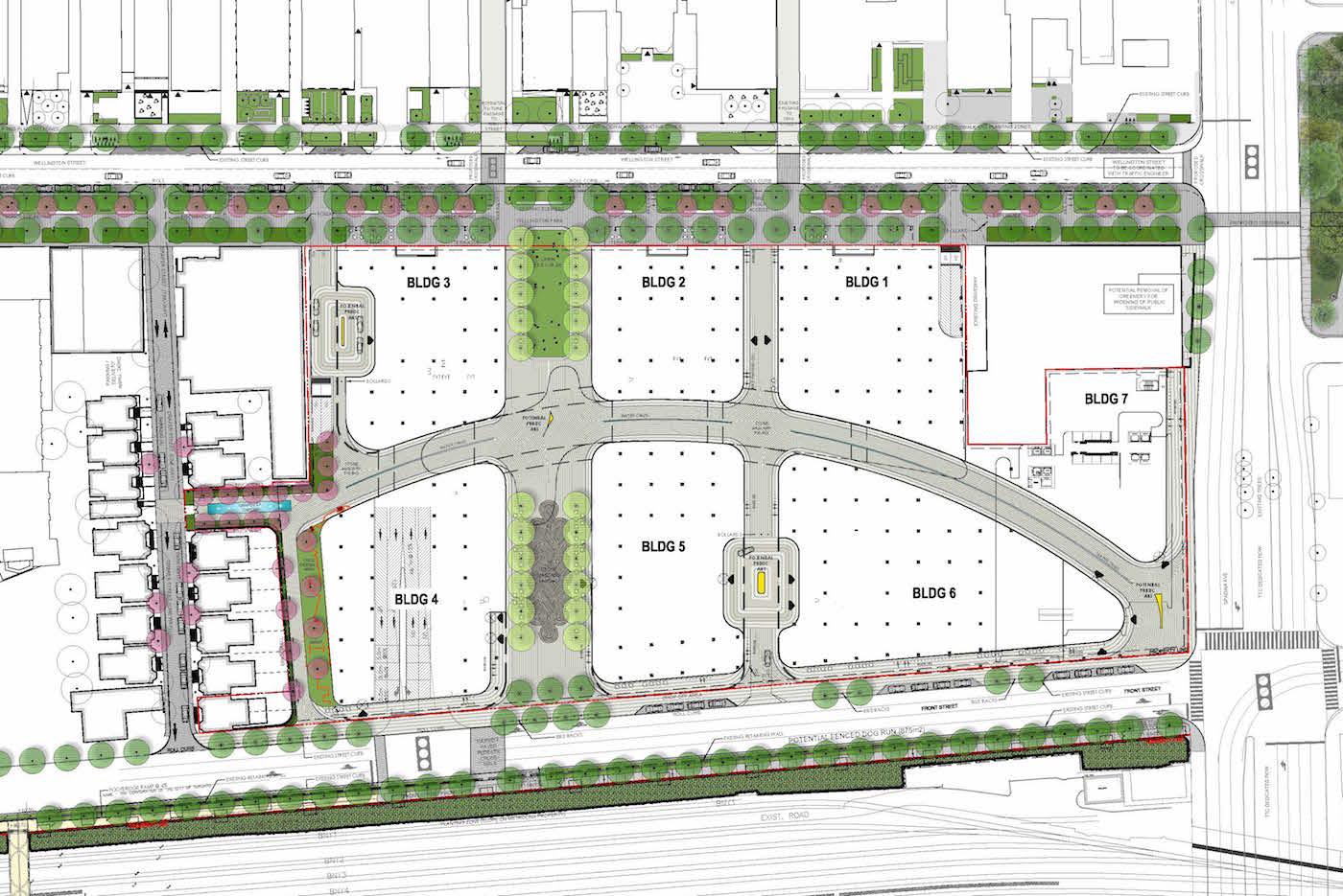
Perhaps someone can help me out.

It's not clear how much of this is pedestrian only and how much of it will have car access. Can someone help?
the only part that will have cars from my understanding is the courtyard between building 5 and 6.
 
It looks like also on the west side of building 3?

And on the far left between the unnumbered buildings?

On the west side of Building 3 is a ramp down to P3. The far left road is Draper Street, a public road that will receive additional tree plantings
 
Does anyone know if there are any developments planned for the parking on the other side of the intersection the well is on?
 
Does anyone know if there are any developments planned for the parking on the other side of the intersection the well is on?
Use our map section (linked here and at the top of every page) to find what you're looking for. All the threads that have database files attached appear on the map. (Database files are eventually created for all developments of significance.)

42
 
Use our map section (linked here and at the top of every page) to find what you're looking for. All the threads that have database files attached appear on the map. (Database files are eventually created for all developments of significance.)

42
Oh wow I didnt know we had this, this is cool, thanks!
 
Wow is that ever a sea of uninspiring buildings. Will the well be tall enough to peak over the white/light blue building in front of it from this angle?
 

Back
Top