adma
Superstar
Interesting in the southward view, too, to reflect upon how many now lopped-off bobbly parapets, cornices, gables once existed--now it's all relatively flat-topped...
|
|
|
Wouldn't a substantial reason for the demolition of Toronto's old architecture be that some wise developers have great ambitions - and a desire for wealth?
They see an opportunity to profit by replacing the old with something new and there are, apparently, plenty of customers for the various schemes.
I actually have an account I service in that old warehouse building! It's so old inside it's incredible, it still looks like it's from the late 1800's in there. They haven't really done any modernizations to it at all expect for the main lobby (which was done sometime in the '70's). It sits at the corner of Front and Spadina.thedeepend, this reminds me that the practice of some business owners of claiming descendance from a long unbroken line of heritage is pushed a bit sometimes for marketing. Indian Motorcycles comes to mind.
Thanks Stumack. What's the rear diff ratio on a 64 Comet then?
I love aerials. Really lets you see the Big Picture.
November 7 addition.
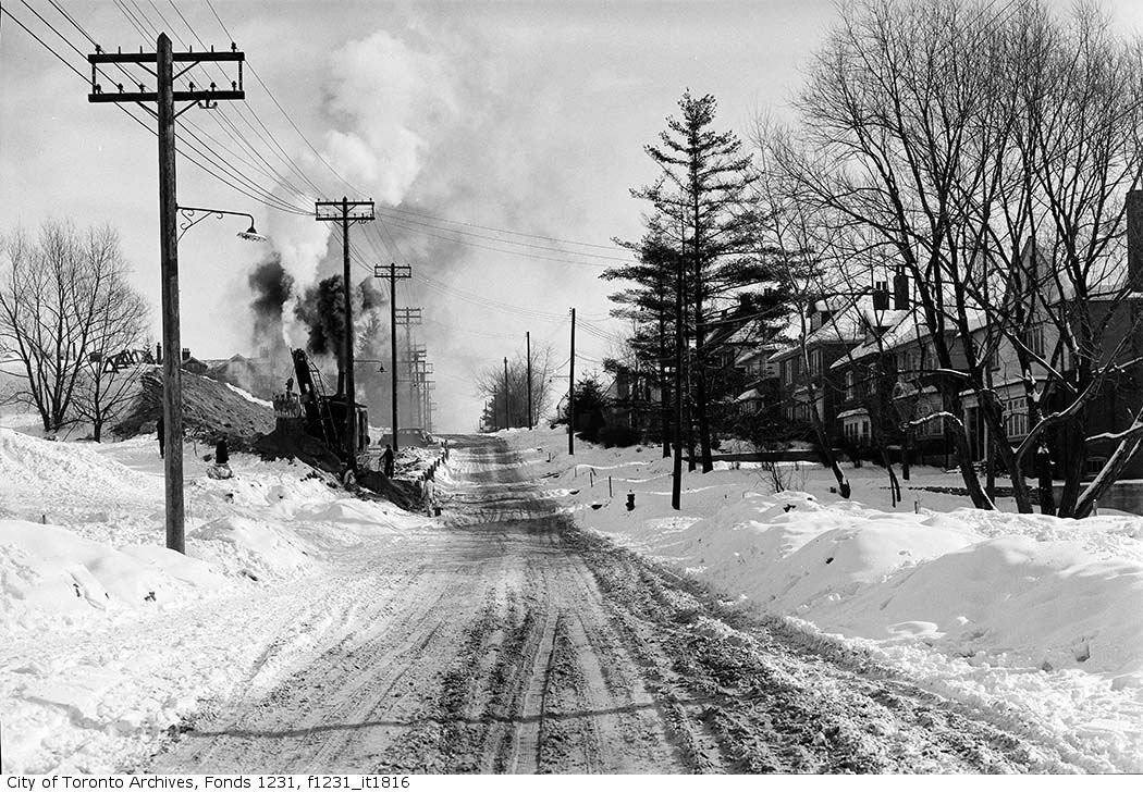
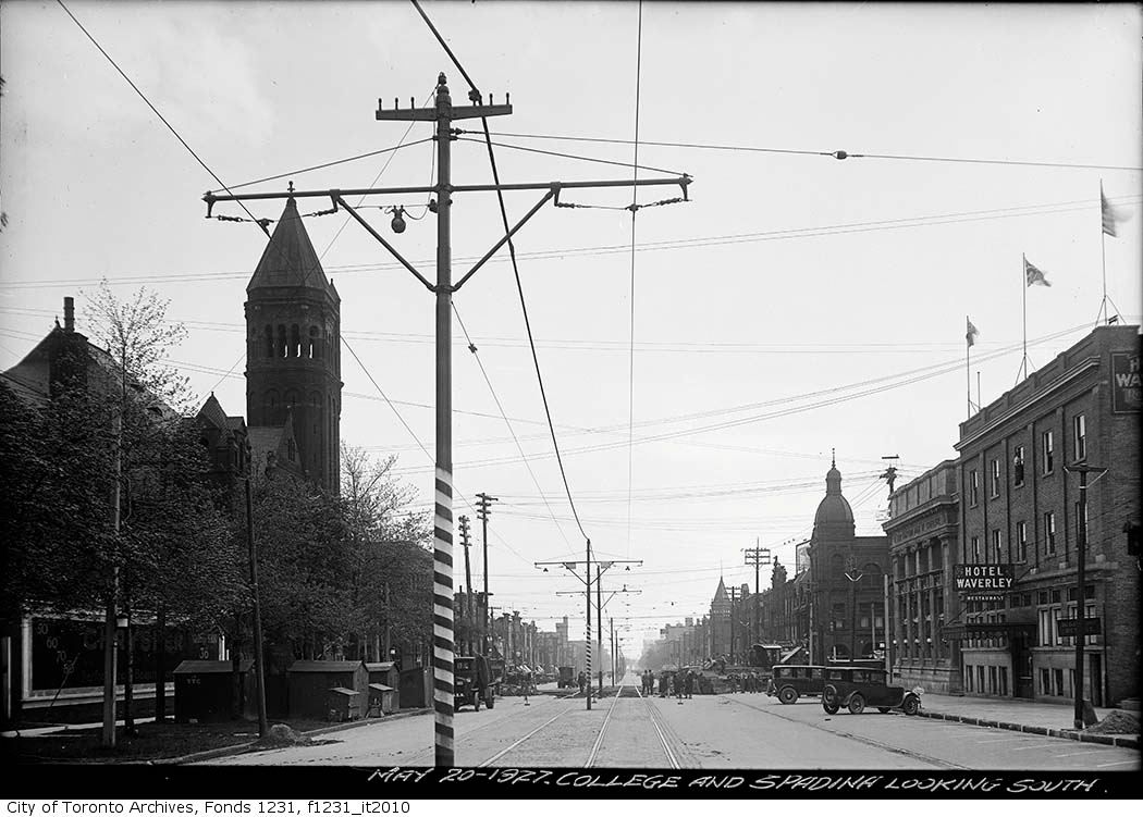
Then: 1909? Even the person writing the caption of the old photo is guessing. Spadina looking N from the then lake, as landfill operations are going on in a big way. By horse and wagon.
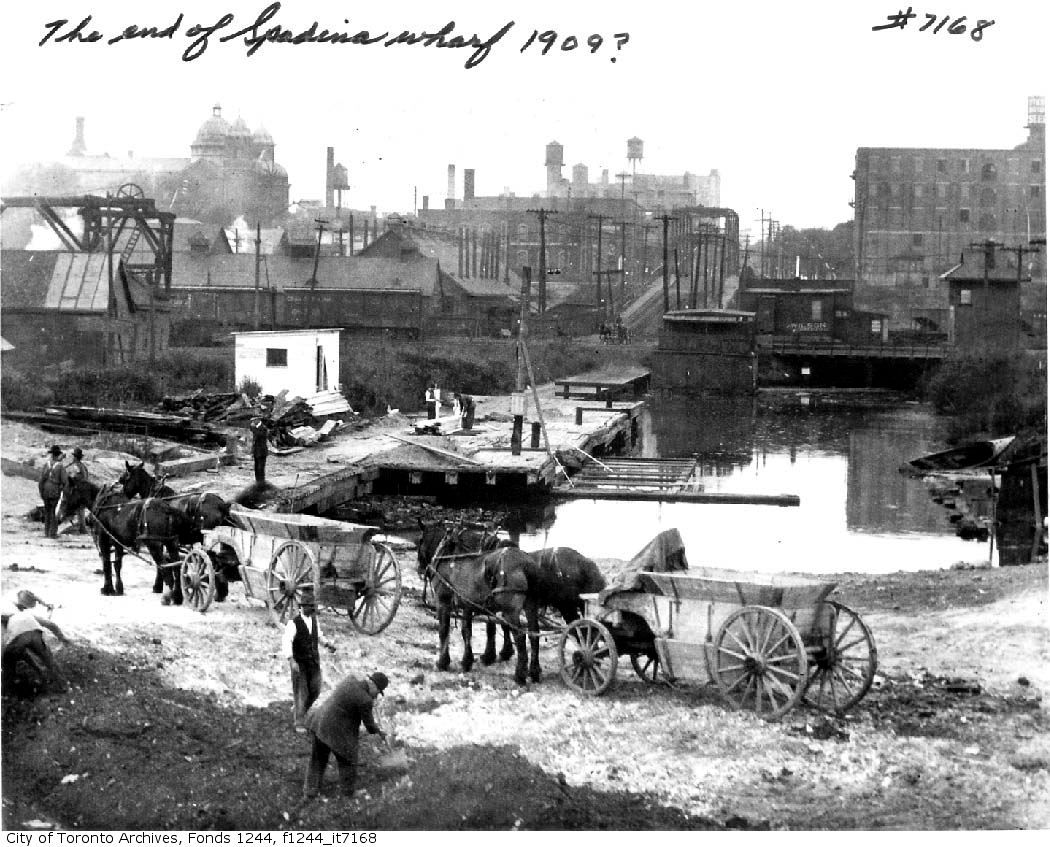
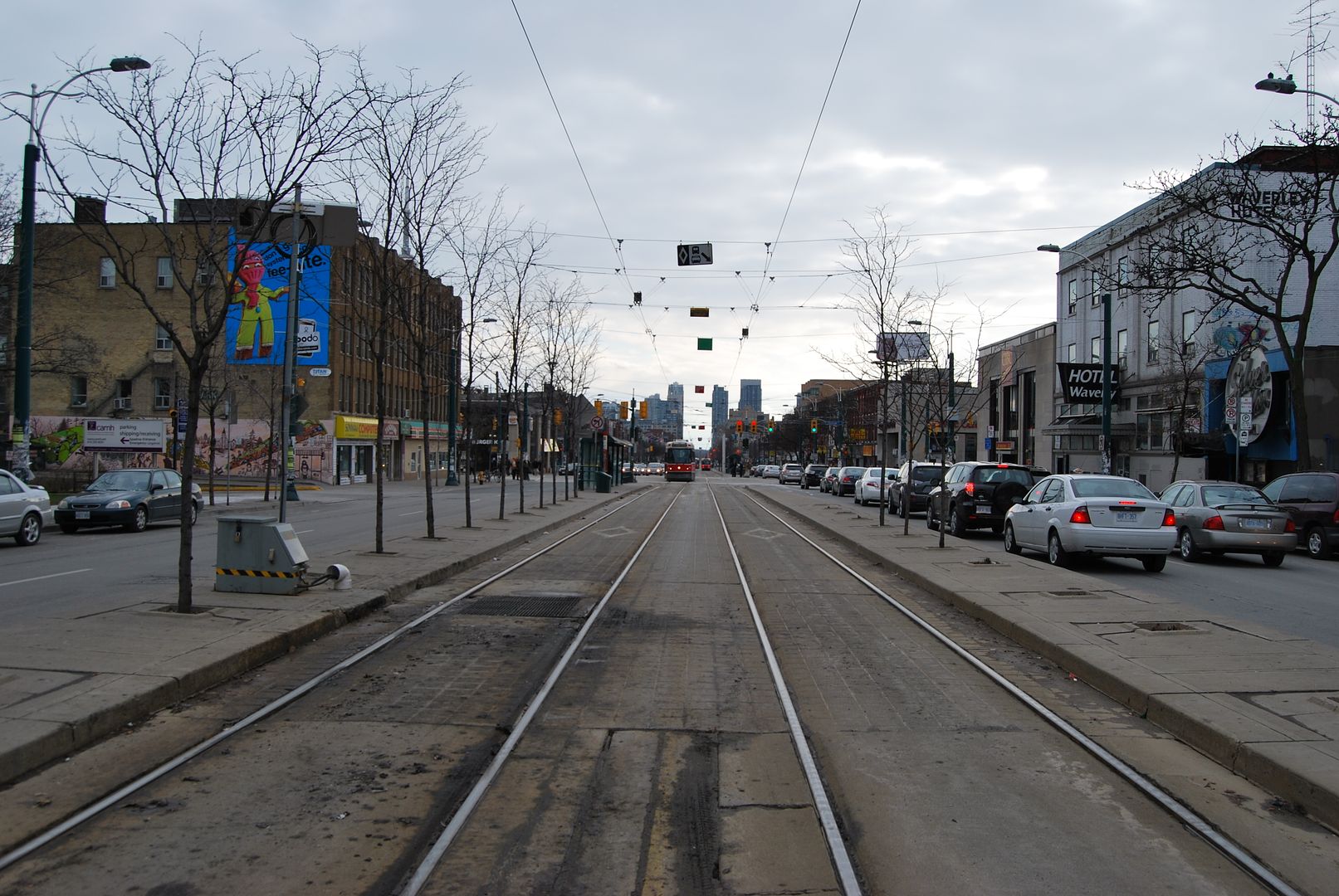
Now: October 2009. Note that the warehouse on the right is till there. On the left of the picture, Loretto Abbey looms like a ghost, and that's what it is, as it's long gone.
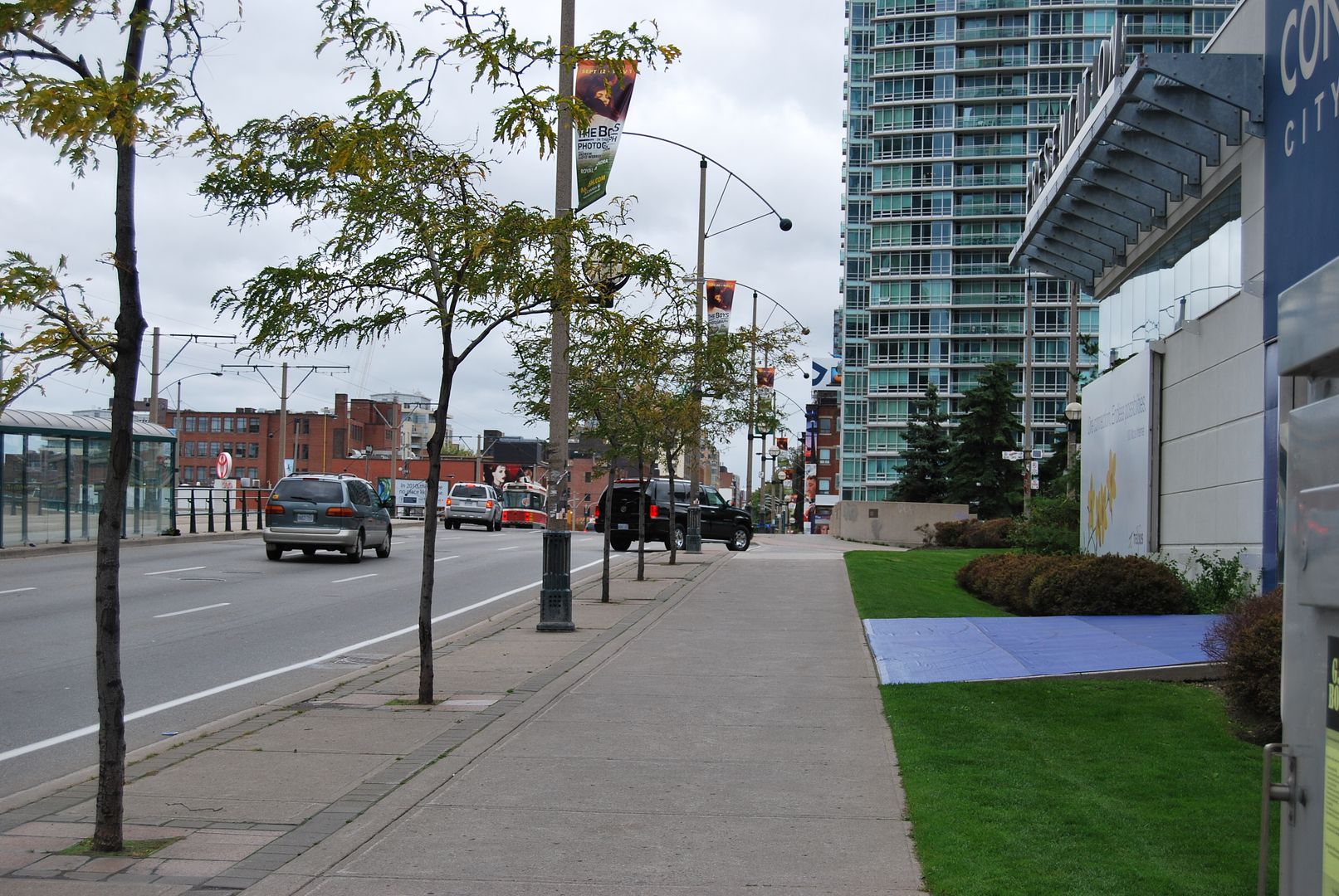
Interesting in the southward view, too, to reflect upon how many now lopped-off bobbly parapets, cornices, gables once existed--now it's all relatively flat-topped...
I actually have an account I service in that old warehouse building! It's so old inside it's incredible, it still looks like it's from the late 1800's in there. They haven't really done any modernizations to it at all expect for the main lobby (which was done sometime in the '70's). It sits at the corner of Front and Spadina.
Awesome Thread BTW!!
"Anna" posted a another view of Glengrove awhile back showing that row of trees . There was an estate here as well as a later racetrack,,, so I suppose the estate owner planted them; perhaps flanking a driveway
James Beaty (one "t") purchased the property as a summer home from the Nanton family in 1855. He named it Glengrove (or Glen Grove) Farm, and the house was called Glen Castle. Glengrove Ave. was indeed the driveway.

Seems like quite a hill in the photo, though, so I wonder if it on the east side of Yonge Street heading down towards the Blythwood Ravine?
Ah right, I did a search and found the discussion and the photo you mentioned, thanks!... Glen Grove park, and apparently
I wonder if this is a photo of Glen Castle. I'm not sure where the creek would have run along here, but I figured it was about here in North Toronto
(Details on the circa 1910 photo at http://gencat.eloquent-systems.com/torontodetail.html?key=87656 )
Seems like quite a hill in the photo, though, so I wonder if it on the east side of Yonge Street heading down towards the Blythwood Ravine?
")
What if it was Duplex (or whatever street preceded it) looking south? Chatsworth ravine is pretty steep west of Yonge and just north of Glengrove and Duplex is basically a berm crossing the ravine these days.
http://maps.google.com/maps?f=q&sou...cKUQLKboCwAKHpxis4vzcA&cbp=12,177.82,,0,-0.93
I'm pulling together several threads out of those very unswept areas of my brain.
There is a street somewhere close by named Glen Castle. Perhaps it is the one immediately east of John Ross Robertson School (or have the powers that be had the nerve to change the name of the school?). The bridge can't be the one I remember from the first half of the 1950s, but at that time there was a bridge down in the ravine. We didn't move from north of Lawrence to Glenview (facing into Havergal) till 1957, but school friends from Lawrence Park who lived east of John Ross Robertson walked to school by way of the bridge in the ravine. In the spring, it was mud, glorious mud!!! all the way from there across the flats behind the school.
But where was the racetrack? Two possibilities: the crescent which links Alexandra Blvd and Lytton at the tennis courts or the grounds of Havergal College. Maybe I will get around to looking up evidence at Toronto Archives when I am back in May.
There is a street somewhere close by named Glen Castle. Perhaps it is the one immediately east of John Ross Robertson School (or have the powers that be had the nerve to change the name of the school?).
There are pictures at the archives of 54 and 62 Glenview dated 1950/51 – that are probably the houses on the south side that were taken out when Duplex was extended.What if it was Duplex (or whatever street preceded it) looking south? Chatsworth ravine is pretty steep west of Yonge and just north of Glengrove and Duplex is basically a berm crossing the ravine these days.
I agree with your guess that your picture scene might be on the east side of Yonge - Blythwood Ravine. I could be wrong but I haven't been on Glengrove Avenue east in decades; it's a short no-exit street and I have no reason to be there but I don't think there is an extant house like that.
There's a 50’s bungalow that could be located where that house was – but I don’t see any turreted house anywhere on the 1910 Goad map. I haven’t walked the dog to Alexander Muir Park since the fall and I can’t recall what the view from the valley looks like – if it was Glengrove east that would be the approximate area from which the photo was taken. According to a 1931 topographic map, Glengrove east went down the hill, over the brook, and joined up with Glengowan.

I'm pulling together several threads out of those very unswept areas of my brain.
There is a street somewhere close by named Glen Castle. Perhaps it is the one immediately east of John Ross Robertson School (or have the powers that be had the nerve to change the name of the school?). The bridge can't be the one I remember from the first half of the 1950s, but at that time there was a bridge down in the ravine. We didn't move from north of Lawrence to Glenview (facing into Havergal) till 1957, but school friends from Lawrence Park who lived east of John Ross Robertson walked to school by way of the bridge in the ravine. In the spring, it was mud, glorious mud!!! all the way from there across the flats behind the school.
But where was the racetrack? Two possibilities: the crescent which links Alexandra Blvd and Lytton at the tennis courts or the grounds of Havergal College. Maybe I will get around to looking up evidence at Toronto Archives when I am back in May.
Thanks for your recollections, nomoreatorontonian...
I should have asked my gramps a few more questions before he passed - he moved into North Toronto in 1926, never left, and passed in 1979. He did tell me there was watercress to be gathered in the ravine at the southwest corner of St. Clements and Rosewell - you can still make out the ravine behind the houses. And there was a dealer in live chickens at the north east corner of Castlefield and Duplex - it's a "Green P" parking lot now. He used to tell me this stuff as we drove around; I was inured to it as a youngster; as I thought he prattled on a bit much. I'm surprised I remember this stuff.
normoreatorontonian, do you remember the abandoned RCAF hospital on the north side of Sheldrake? Just off Yonge street. Brynhurst Court and Georgian Court - built in the late 60s - occupy where it once was.
As for the racetrack... the crescent you mention dips into the ravine and back up; I think horse racetracks are flat.
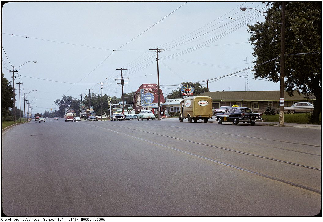
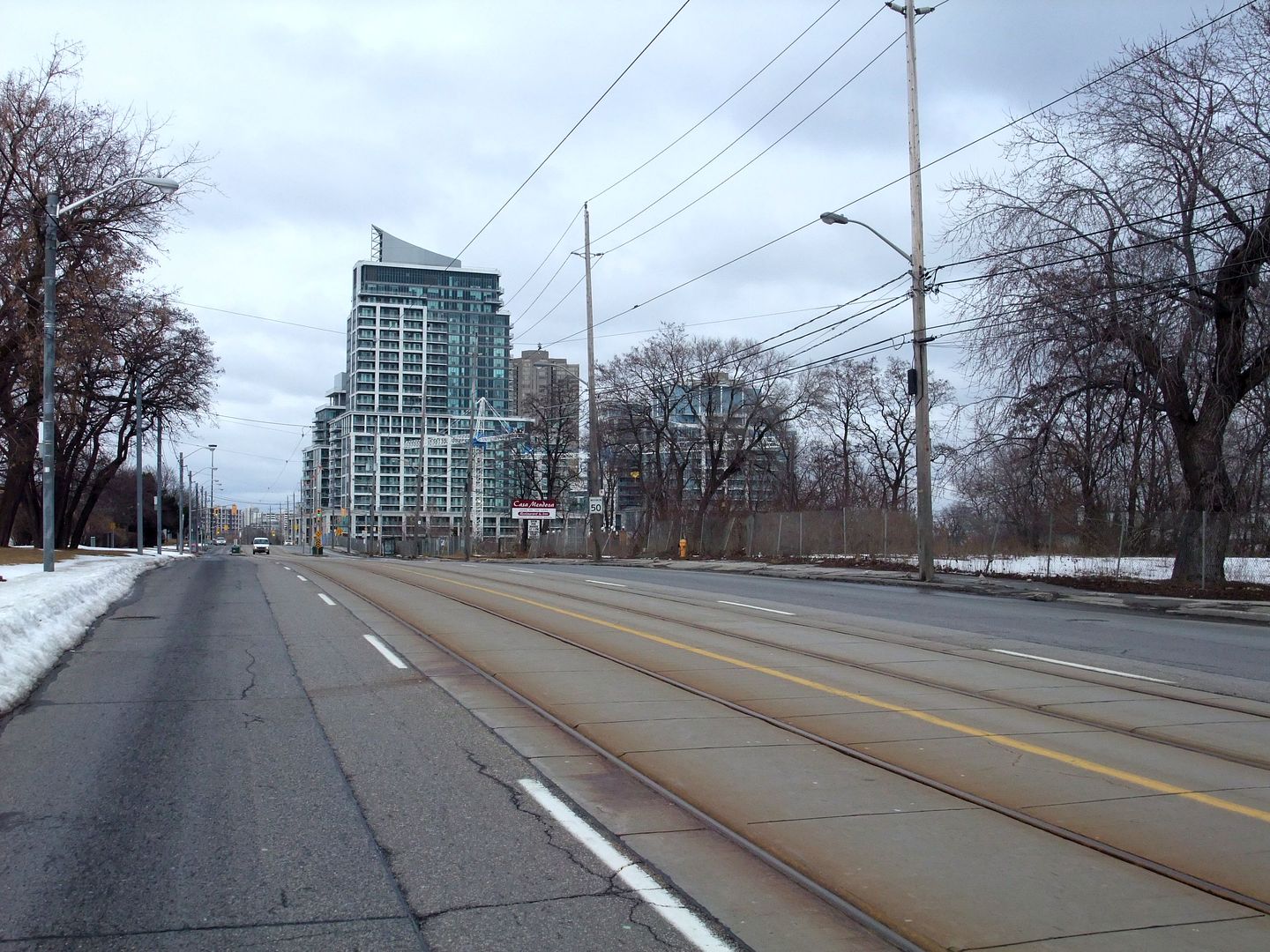
"Now: March 2010. Our little hotel strip has only two motels left: Casa Mendoza - you can only see the sign... " QUOTE, Mustapha.
The Dutch Sister's Inn became Casa Mendosa after it was leveled by fire.
"and the Beach Hotel which is out of sight to our right." QUOTE, Mustapha.
The Beach Motel was/is owned by the Buttwell family, who were originally in the
business of brick making.
Regards,
J T
Yes, Glen Castle is the street just east of JRR, and no, they haven't changed the name of the school. I was just looking at Glen Castle on Google streetview - and there is a house with a turret - but not the same one.
There are pictures at the archives of 54 and 62 Glenview dated 1950/51 – that are probably the houses on the south side that were taken out when Duplex was extended.
I was there on Thursday.
There is also this photo that appears to have been taken around the same place. If it's Glengrove east I can see why it's now a dead end. The photo description says - See also Fonds 1244, Item 7030 for later picture – which is our picture of the flapper & the trees on Glengrove west.
I don’t think it is the Blythwood Rd bridge.