News   GLOBAL  |  Apr 02, 2020
 9.7K     0 
News   GLOBAL  |  Apr 01, 2020
 41K     0 
News   GLOBAL  |  Apr 01, 2020
 5.5K     0 

Map of York

A friend gave me this small version of a map she found. Ironically, it was in Montreal.

It's a map of York, not Toronto. And there is no date on it, and she feels bad.

Anybody have any dirt on this map of ... dirt? It's mostly showing farm plots back then, and gives an indication of a lot of street names in Leslieville.

York Map yor-m-york-se.jpg


Sorry, that file is just too small. That is 350 kB, my version is 6 MB, and my friend's version is 45 MB.

Anyway if anybody has an idea about it, let me know. If anybody wants the original, I can make it available somehow. I have no accounts on photo sites. Maybe someone can clean up and host the original.
 

Attachments

  • York Map yor-m-york-se.jpg
    York Map yor-m-york-se.jpg
    97.5 KB · Views: 973
" if anybody has an idea about it" QUOTE BeeRich.


GUESSTIMATE - 1870's.

Regards,
J T
 
Daily Miscellaneous Then and Now for Thursday May 12, 2011:


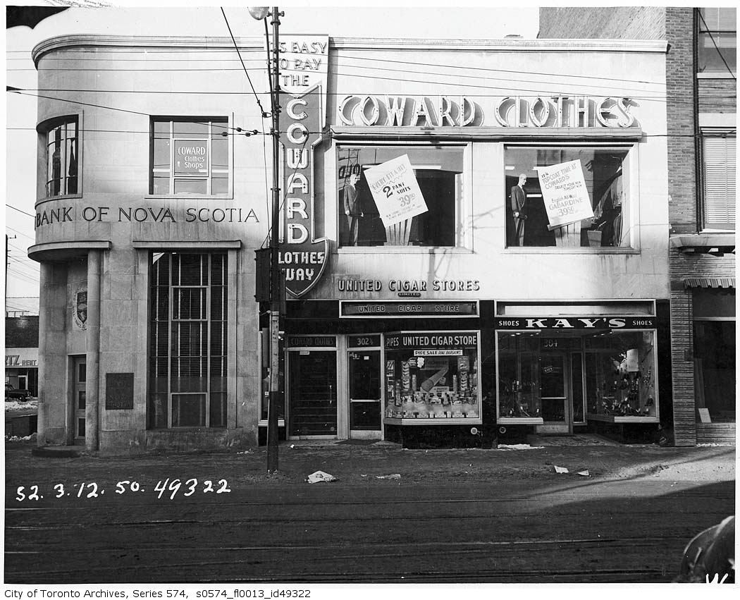
Then. NW corner of Yonge and Dundas. March 12, 1950.


This intersection - if not exactly "historic" in terms of events or architecture - is one of Toronto's old commercial and transportation hubs. The area now encompasses a public square on the SE corner that is steadily gaining traction over the last few years for commercial and political events as well as just plain people watching. In addition, the unchanged "menu" that has been Yonge Street down through the years, namely: fast food to middling restaurants, movie theatres, book, camera, and clothing stores completes the list of attractions near the Dundas and Yonge crossroads.

I wonder how many of us have walked by this former ScotiaBank branch without a thought. In fact it is the last original building on these four corners from the last century.


s0574_fl0013_id49322.jpg


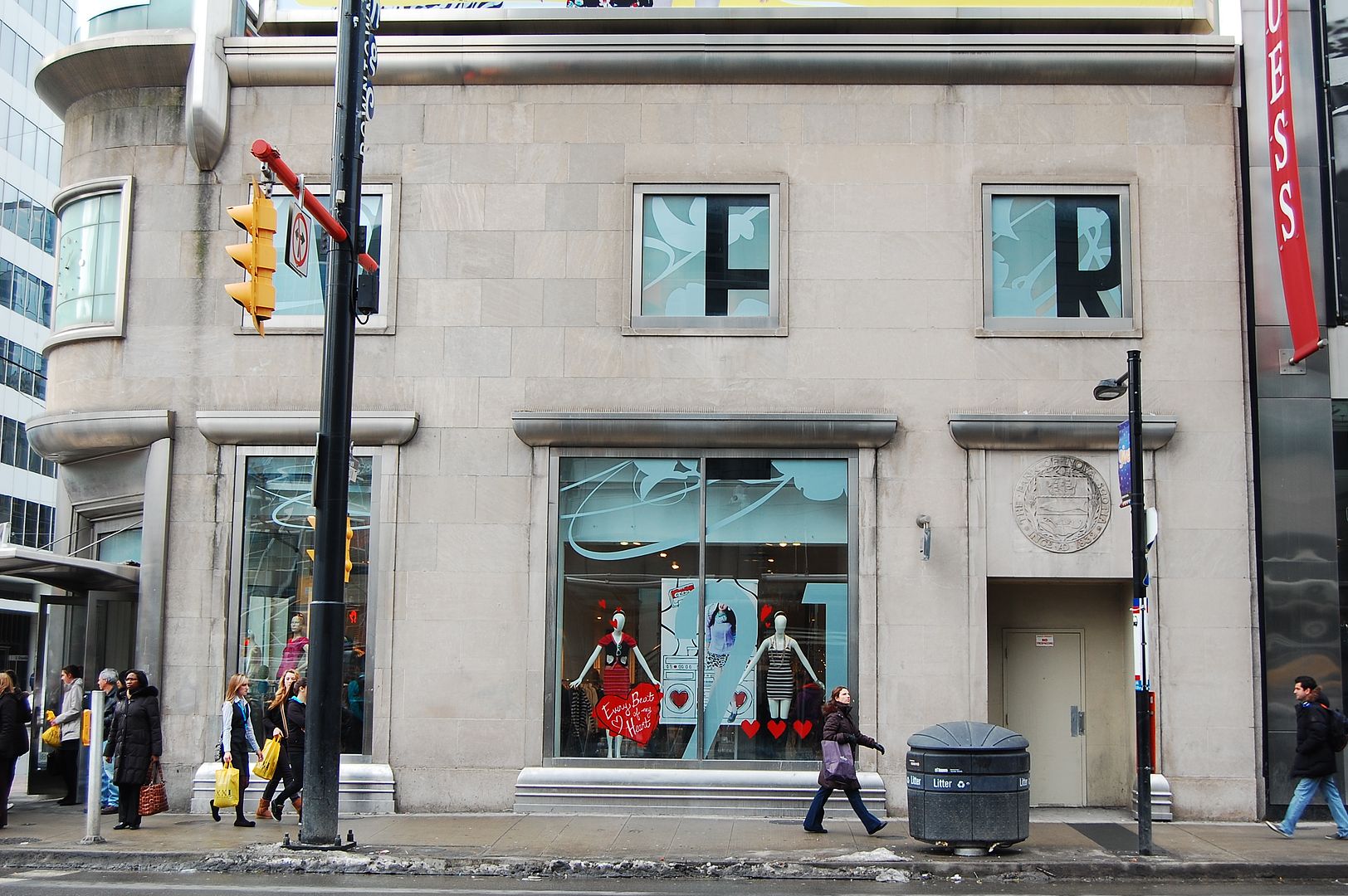
Now. February 2011.


DSC_0194.jpg
 
From what I understand that intersection had some City incentives for big names to come into the hood during the re-design of that strip there. Looks like a bank. So is Giovanni's (The Nose) as is The Real Jerk.
 
That's the east side of York Township in the 1860 series of Tremaines' maps of Canada West Counties. The Tremaine brothers were based in Montreal, so that's how it got there. It took three maps to surround Toronto.

I "redrew" them in sections on computer earlier this year. Don't think I quite finished the western side.
 
I will pass this information on to the person who gave it to me. I'm sure she would be interested in what you have done. She too is working on a re-worked version.

Cheers
 
It would have to be later than 1864 - the year that The Don Jail was built.

Regards,
J T
 
Another view of the Yonge-Dundas corner. The subsequent renovation was suprisingly sensitive.

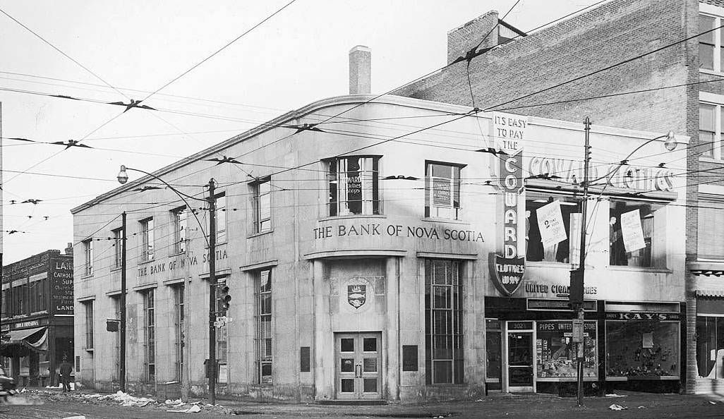
PHOTO-TORONTO-YONGEANDDUNDAS-NWCORNER-1950.jpg


A compilation from lost-toronto (1950):

yongedundaswest1950-1.jpg


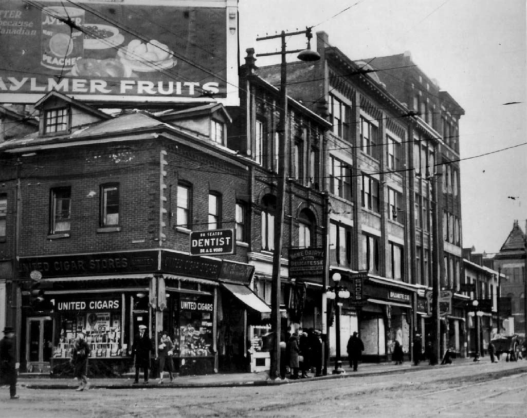
And in 1926:

1926_Toronto_NW_YongeandDundas.jpg
 
Last edited:
A friend gave me this small version of a map she found. Ironically, it was in Montreal.

It's a map of York, not Toronto. And there is no date on it, and she feels bad.

Anybody have any dirt on this map of ... dirt? It's mostly showing farm plots back then, and gives an indication of a lot of street names in Leslieville.

View attachment 7365

Sorry, that file is just too small. That is 350 kB, my version is 6 MB, and my friend's version is 45 MB.

Anyway if anybody has an idea about it, let me know. If anybody wants the original, I can make it available somehow. I have no accounts on photo sites. Maybe someone can clean up and host the original.

Looking again, that's the 1878 map. You can tell from the label NOR-WAY. There was another series done in 1860. Both are reproduced in Derek Hayes' An Historical Atlas of Toronto.
 
A friend gave me this small version of a map she found. Ironically, it was in Montreal.

It's a map of York, not Toronto. And there is no date on it, and she feels bad.

Anybody have any dirt on this map of ... dirt? It's mostly showing farm plots back then, and gives an indication of a lot of street names in Leslieville.

View attachment 7365

Sorry, that file is just too small. That is 350 kB, my version is 6 MB, and my friend's version is 45 MB.

Anyway if anybody has an idea about it, let me know. If anybody wants the original, I can make it available somehow. I have no accounts on photo sites. Maybe someone can clean up and host the original.

Looking again, that's the 1878 map. You can tell from the label NOR-WAY. There was another series done in 1860. Both are reproduced in Derek Hayes' An Historical Atlas of Toronto.
 
Another view of the Yonge-Dundas corner. The subsequent renovation was suprisingly sensitive.

PHOTO-TORONTO-YONGEANDDUNDAS-NWCORNER-1950.jpg

It *looks* as if Coward Clothes was integral--was it subsequently renovated into an expanded version of the bank? (And was/when was the Scotia shield transferred to the Yonge st side from the corner?)
 
It *looks* as if Coward Clothes was integral--was it subsequently renovated into an expanded version of the bank? (And was/when was the Scotia shield transferred to the Yonge st side from the corner?)


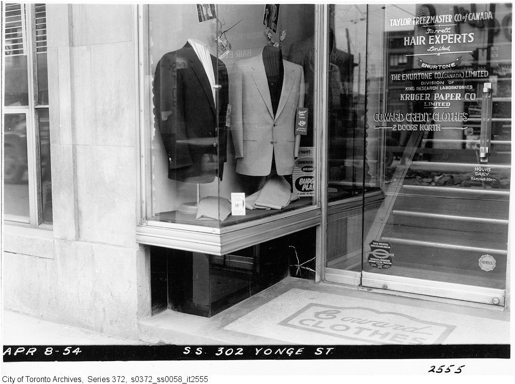
Close up of Coward clothes shop window...


s0372_ss0058_it2555-1.jpg


thecharioteer, agree with you about the subsequent renovation to close up those storefronts. It's like they were never there.
 

Back
Top