News   GLOBAL  |  Apr 02, 2020
 8.5K     0 
News   GLOBAL  |  Apr 01, 2020
 39K     0 
News   GLOBAL  |  Apr 01, 2020
 4.7K     0 

Out of interest's sake... Why is the Eastern part of Danforth south of Crescent Town considered part of East York?

Wouldn't it have just made more sense to call it Danforth?
 
Out of interest's sake... Why is the Eastern part of Danforth south of Crescent Town considered part of East York?
I believe it was because that eastern part of Danforth was in the Borough of East York, and not in the City of Toronto.

I'm amazed at how hard it is to find an accurate map of the boundaries of East York (it's only been 13 years since it joined Toronto). I think the old Rand McNally road maps of the city had the boundary ... I'll have to dig one out of the basement one day.

But this appears to be correct ... at least for the southern boundary.
Old_East_York_map.PNG
 
Thanks... I realize that, but I was just wondering what the rationale was for having that little corner tacked onto East York. Is it because of the train tracks? If so, one might expect the few blocks west of there also to be part of East York but they're not.

Just curious. Just a random town council type decision?

Next time I'm there I'll have to remember to look for any changes in the nature of the neighbourhood, if any.
 
Thanks... I realize that, but I was just wondering what the rationale was for having that little corner tacked onto East York. Is it because of the train tracks? If so, one might expect the few blocks west of there also to be part of East York but they're not.

Just curious. Just a random town council type decision?
Good question. I guess it's a function of the old boundaries of the various towns and villages that got almagamated into Toronto. I think it is a function of the old East Toronto boundaries, that got incorporated into Toronto in 1908. This 1908 map seems to suggest that (how come I can find an East Toronto map easier than a East York map!).
East_Toronto_map.PNG


Next time I'm there I'll have to remember to look for any changes in the nature of the neighbourhood, if any.
With Shoppers World on the south, it has a hugely different feel than the rest of the Danforth!
 
Good question. I guess it's a function of the old boundaries of the various towns and villages that got almagamated into Toronto. I think it is a function of the old East Toronto boundaries, that got incorporated into Toronto in 1908. This 1908 map seems to suggest that (how come I can find an East Toronto map easier than a East York map!).
East_Toronto_map.PNG

Exactly. Don't blame East York; blame the annexation patterns of the former City of Toronto (and remember: East York was a township, not a city--cities tended to annex from townships, not vice versa)
 
(and remember: East York was a township, not a city--cities tended to annex from townships, not vice versa)
I'm not sure East York was ever a township.

This was all York County (present day City of Toronto, Region of York. And the County was divided into either townships and the City of Toronto. Etobiocoke was Etobicoke Township. Scarborough was Scarborough Township. But as far as I know, York, East York, and North York were all just York Township. At least that was the case in the 1880s, and likely still in 1908 when Toronto East was annexed by Toronto.

If you look at the 1880s map - http://digital.library.mcgill.ca/CountyAtlas/images/maps/townshipmaps/yor-m-york-se.jpg (which I won't imbedd, as it is several MB) you can see the pre-East Toronto map ... and there's no indication why that wasn't part of East Toronto; particularily as part of that lost IS East Toronto. My guess is the east limit was simply a north-south line, which got extended eastward to include the old Grand Trunk yard that stretched to Victoria Park (i.e. Loblaws). And later the remaining few blocks between Toronto East and Scarborough south of Upper Gerrard (formerly Lake View Avenue) got annexed. But I'm guessing.
 
As an old East Yorker circa 1944 - 1960 I can assure you the municipality was much larger than shown on the map. Parkview Heights, Topham Park, and Woodbine Gardens were all in the Township. My wife, before our marriage, lived one block south of St. Clair, west of Victoria Park in East York.
 
I was only using that figure to show the southern boundary. To the north it stretched to near Eglinton; I'm well aware, I lived in Flemingdon Park, in East York, in the 1980s.

A good map would be interesting. It's odd how hard it is to find out exactly where it was, only 13 years after it was merged into Toronto.
 
I'm not sure East York was ever a township.

This was all York County (present day City of Toronto, Region of York. And the County was divided into either townships and the City of Toronto. Etobiocoke was Etobicoke Township. Scarborough was Scarborough Township. But as far as I know, York, East York, and North York were all just York Township. At least that was the case in the 1880s, and likely still in 1908 when Toronto East was annexed by Toronto.

Actually, East York *was* a Township--but only from 1924 onward, after the former York Township was split into three. (But it still doesn't disprove by "cities annex from townships, rather than vice versa" point--indeed, it was North York's creation two years earlier that led to East York itself incorporating, as successive Toronto annexations left the two remaining halves of York geographically unconnected.)

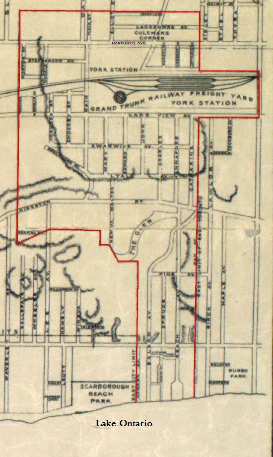
Oh, and York County wasn't just divided into townships and Toronto--there were other incorporated cities/towns/villages, from Toronto satellites like North/East/West Toronto, Weston, Leaside, etc, to Newmarket, Aurora, Richmond Hill, Markham, Woodbridge, Stouffville et al. And they all came about by being incorporated from/annexing from townships, often with a rhyme and reason that's casually lost to us today. (IOW, the Munro Park area south of the Grand Trunk yards would most likely have been an insular part of York Township before it was all annexed into Toronto. Bearing in mind that Victoria Park was *always* (East) York's eastern boundary, and had been from Simcoe times onward.)

Incidentally, a possible clue to why East York dips below Danforth at that point may be in the Ford plant that previously stood upon the Shopper's World site (cheap land + tax/regulation dodges?). And by the time Ford moved out, the municipal-annexation-by-dribs-and-drabs urge had passed--we were entering the Metro era, after all, where all was equal and boundaries were little more than fortuitous grandfathered-in lines on a map. The only remaining boundary changes of note were the amalgamating-away of the remaining towns and villages (whereupon Leaside became part of East York, and Forest Hill and Swansea joined Toronto); the addition of West Rouge to Scarborough in the 1970s; and mega-amalgamation in 1997...
 
I was only using that figure to show the southern boundary. To the north it stretched to near Eglinton; I'm well aware, I lived in Flemingdon Park, in East York, in the 1980s.

I thought Flemingdon Park was part of *North* York--*Thorncliffe* was in East York; the Overlea Bridge connected the two. (But the arbitrariness of municipal boundaries is such that I think maybe the southernmost apartment building in the Flemingdon zone was within East York jurisdiction.)
 
I thought Flemingdon Park was part of *North* York--*Thorncliffe* was in East York; the Overlea Bridge connected the two. (But the arbitrariness of municipal boundaries is such that I think maybe the southernmost apartment building in the Flemingdon zone was within East York jurisdiction.)
Hey ... it's a long time ago ... I remember the East York signs at Thorncliffe ...

You inspired me to pull out my old 1994 Toronto atlas. You are correct. The West Don is the boundary between North York and East York, to just south of Overlea ... and it looks like the final apartment building on Don Mills south of Overlea, was actually East York. So I guess I was living in North York ... but if I tossed a ball out of the back window, it would have landed in East York.

Hmm, I hadn't realised that Woodbine subway station was in East York ... I guess East York DID have a subway!
 
Hmm, I hadn't realised that Woodbine subway station was in East York ... I guess East York DID have a subway!

It'll have a bona fide line on the map eventually if they ever get the DRL ball rolling.
 
This thread has been inactive for a while, so I thought I'd add my thoughts to it to keep it running. It started with a discussion on the name of the neighborhood -- something I have thought about often since moving to East Toronto. Although initially quite opposed to the name Upper Beach due to its marketing origins among real estate agents, I am reluctantly warming up to it for lack of an appropriate substitute. I will agree with Beachers that this part of East Toronto (Woodbine-Victoria Park, and Kingston Rd-CNR tracks north of Gerrard St) is not really the "Beach". The Beach is certainly close enough to walk, but this area's history and geography have more of a transit history (trains, trams) than the Beach. On the other hand, some of the older village and hamlet names have disappeared like Norway, Ben Lamond, and the larger Village of East Toronto, leaving us without either small local names or a greater common name.

The city's website uses a fine term for us all -- East End-Danforth, and I'd be happy to use it if anyone else did. But I have never seen this name on signage, local papers, real estate ads, or spoken by anyone living in the area. All of the new townhouses on the old Grand Trunk Railway yards are boasting the name Upper Beach, so there will be hundreds of newer residents there for whom Upper Beach is the only name for the community. It's even in my hard copy Perly's map of Toronto. Should we just embrace the name and move on?

I wanted to get people's thoughts on the Upper Beach(es), more specifically, whether or not it actually exists.

I was around Woodbine & Gerrard this morning and pondered whether or not the "Upper Beach(es)" identity was simply beneficial for the real estate industry (its likely originator) or good for the overall identity of the neighbhourhood which would otherwise be nameless.

As well, if you acknowledge the "Upper Beach(es)" classification, how would you define its borders? Kingston Rd to Gerrard, Coxwell to Vic Park? And where does the Upper Beach(es) turn into Riverdale/Leslieville?

I know the boundaries of particular neighbhourhoods has sparked debate on UT, so I hope this would continue such discussion.
 
Last edited:
The city's website uses a fine term for us all -- East End-Danforth, and I'd be happy to use it if anyone else did.
Hmm, so it does - http://www.toronto.ca/demographics/cns_profiles/cns62.htm

But only for east of Woodbine. For west of Woodbine to Coxwell, from Milverton to Kingston road/Queen, it's "Woodbine Corridor".

As much as I don't like the Upper Beaches name ... the area (south of the tracks, north of Kingston) doesn't quite fit in with the City's scheme, that lumps in stuff north of Danforth, with stuff along Kingston Road.
 

Back
Top