News   GLOBAL  |  Apr 02, 2020
 9.7K     0 
News   GLOBAL  |  Apr 01, 2020
 41K     0 
News   GLOBAL  |  Apr 01, 2020
 5.5K     0 

Kind of creepy that my favourite neighbourhood pizza joint is on land formerly occupied by a morgue.

But seriously - check them out - Bellissimo is really good pizza, and cheap. Great neighbourhood vibe, especially when the patio is open.
 
Where Queen meets King at the Don River ------

Looking west:

King-QueenWofDon-horsebuggydays_zpsdd3ae98a.jpg


King-QueenstreetsmeetattheDonriver2014_zpsee2ba53f.jpg


Looking east:

King-QueenatDonlookingE_zpsdf3083f5.jpg


King-QueenatDonlookingE2014_zpsa63f4fd7.jpg


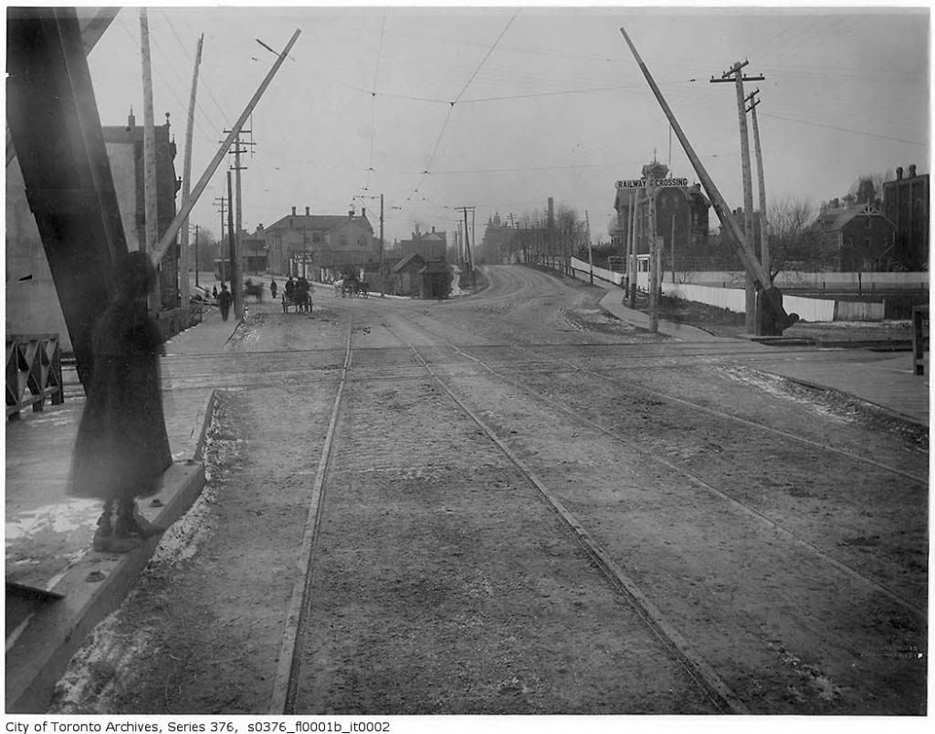
Great pics Goldie. Your post reminds me of another picture with a similar view from the bridge that existed prior to the iron bridge seen in your post:

Then, looking west, around 189? according to the archives citation:


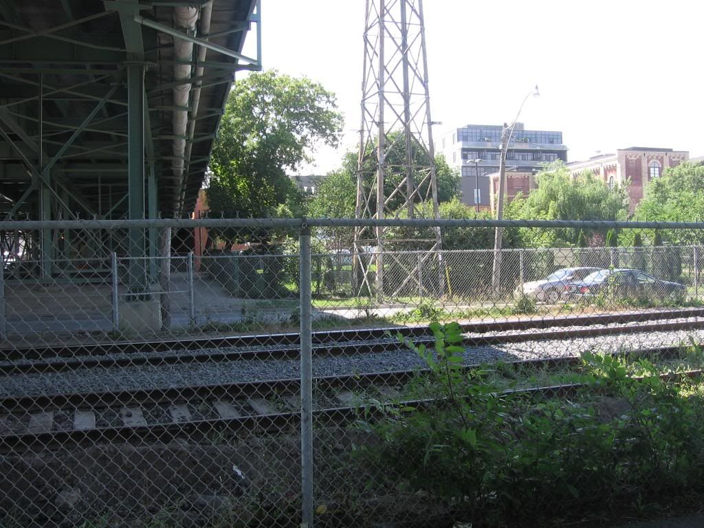
Now, actually last year:


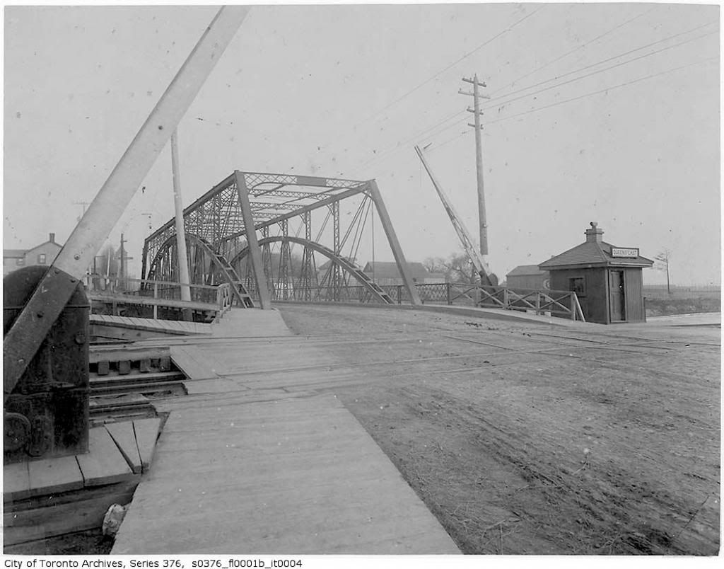
In the then photo, King looks like the more important st with the streetcar tracks veering off the bridge towards downtown while Queen sprouts off to the right, the opposite of the existing configuration. The old brewery building on the right can be seen in both images. Here is the bridge itself:


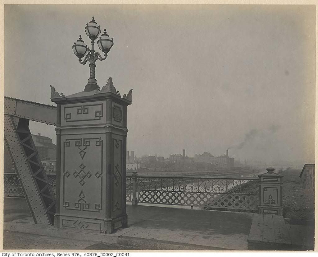
I'm not sure when this bridge was constructed, but the iron bridge after it only lasted about 10 years sadly since the existing viaduct was finished in 1911. Detail of the iron bridge:


While the viaduct separates the RR tracks from Queen and is probably wider, I like how the older bridges are lower to the river.
 
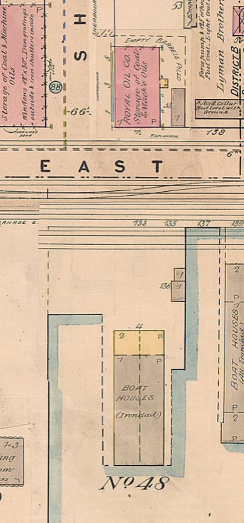
On the west side of Sherbourne and Zooming in I can read : John Fisken - Storage of Coal and Mineral Oil. Fisken had a house at http://www.historicmapworks.com/Map/CA/371/Residence+John+Fisken++J++Ducks+Hotel/

John Fisken was a prominent oil wholesaler and his papers are at the Ontario Archives. Try Googling him.

On the east side it's the Royal Oil Company: storage of coal and oil.

Clearly it was then the 'Coal and Oil District"
 
Can you guys make out the building on the s/e corner of Esplanade and Lower Sherbourne?

It says on the map "Boat Houses (Ironclad)".


Here's a pic from the TPL, 1907, looking south on Sherbourne at The Esplanade. The building in question is to the left:

sherbourneesplanadesouth1907.jpg
 

Attachments

  • sherbourneesplanadesouth1907.jpg
    sherbourneesplanadesouth1907.jpg
    94.1 KB · Views: 964
Last edited:
Huh, interesting. Thanks for the informative replies, guys. I guess then that, judging from the picture directly above, this building was torn down at some point at then the old Siesta Nouveau (recently demo'd) was built there, since the building in the left there looks almost nothing like the old Nouveau building.

I'm just always curious because of some personal history in the Siesta Nouveau building, and always have wanted to know what it was originally built and used for.
 
On the west side of Sherbourne and Zooming in I can read : John Fisken - Storage of Coal and Mineral Oil. Fisken had a house at http://www.historicmapworks.com/Map/CA/371/Residence+John+Fisken++J++Ducks+Hotel/

John Fisken was a prominent oil wholesaler and his papers are at the Ontario Archives. Try Googling him.

On the east side it's the Royal Oil Company: storage of coal and oil.

Clearly it was then the 'Coal and Oil District"

Check out the photo essay I did on Fisken's house "Lawton Park" in the Evocative Images thread last fall (post #2509):

http://urbantoronto.ca/forum/showthread.php/11018-Evocative-Images-of-Lost-Toronto/page168
 
"It says on the map "Boat Houses (Ironclad)"."
The charioteer.

The reason for Goad's Map (Insurance Underwriting Review.) and the appearance of that building, suggests it was in itself

"Ironclad" due to the highly flammable nature of the work carried-on within and all the while, being close to a fuel area; coal/oils.


Regards,
J T
 
Last edited:
Jarvis/Charles 1952:

jarvischarles1952.jpg


2011:

jarvischarles.jpg


And in between from 1953 to 2007, the IOF Building, which became the Metropolitan Police Headquarters (until the one on College Street was built):

JarvisCharles1953IOF.jpg
 

Attachments

  • jarvischarles1952.jpg
    jarvischarles1952.jpg
    100.6 KB · Views: 1,294
  • jarvischarles.jpg
    jarvischarles.jpg
    97.1 KB · Views: 1,275
  • JarvisCharles1953IOF.jpg
    JarvisCharles1953IOF.jpg
    47.5 KB · Views: 1,307
Last edited:
1954 photo showing the fire hall and the original Old No 4 police station. Looks nowhere near the brick example shown on Murdoch Mysteries. Old timers who worked there up to the late 1950s say it was a crap hole. A new police station was built down on Regent Street which became the first 51 Division after amalgamation.
 
Last edited:
Kind of creepy that my favourite neighbourhood pizza joint is on land formerly occupied by a morgue.

But seriously - check them out - Bellissimo is really good pizza, and cheap. Great neighbourhood vibe, especially when the patio is open.

Yep, Bellissimo's is a classic joint. Many good times there. Still drop by sometimes. It's totally a neighborhood joint, and has a lot of 'suburban' charm but right downtown. Classic.
 
British Pathé's entire collection of newsreels is now available for free on YouTube. The 85,000 videos showcase 80 years in global events, ranging from the historically significant to the downright weird.


http://www.youtube.com/user/britishpathe

Toronto Suburban Railway, 1923 - shots of excursion train on the new Keele Street-Lambton bypass, Summerville Curve, Meadowvale, Churchville, and Eldorado Park (now in Brampton).


https://www.youtube.com/watch?v=LEud_a4vWHs
 

Back
Top