


sixrings
Senior Member
You can always run more trains. That would be my simple answer to that. Accessibility is something which should be a priority in 2023.Still not touching on passenger capacity.
|
|
|
You can always run more trains. That would be my simple answer to that. Accessibility is something which should be a priority in 2023.Still not touching on passenger capacity.
The Ctrain is the one and only instance where a low floor would have genuine benefits over high floor in Canada, other than maybe iON and the existing Toronto streetcar network. This doesn't apply to most of the LRTs we're building in Canada, and especially not in suburban Toronto. This is before we get to the fact that internal circulation inside low floor trains are far worse for those in a wheelchair. You're basically stuck sitting right next to the door without an ability to for instance move to a part of the train that's less crowded.And those stations are significantly larger than they need to be if it’s low floor. If you put a lrt in a row the station sizes matter. The ctrain runs downtown in a non car area and in the suburbs more like a go train. Maybe you just don’t like the style of how we’re building lrt (in rows) more than it is about low or high floor.
I'm not sure how we'd benefit running high-floor LRT for Finch, Hamilton, and Hazel McCallion.The Ctrain is the one and only instance where a low floor would have genuine benefits over high floor in Canada, other than maybe iON and the existing Toronto streetcar network. This doesn't apply to most of the LRTs we're building in Canada, and especially not in suburban Toronto.
That's a good point - you see lots of wheelchairs wandering up and down on subway trains - and weaving around the poles.This is before we get to the fact that internal circulation inside low floor trains are far worse for those in a wheelchair. You're basically stuck sitting right next to the door without an ability to for instance move to a part of the train that's less crowded.
I forgot about Hamilton. My point is it was less of a case of we'd benefit of high floor on those lines, and more that there aren't that many benefits of using low floor on those routes, other than maybe MCC station. Low floor really shines when the streetcar tracks are located on the side of the road, and when the station needs to be properly integrated with the existing streetscape. The moment you put the tram tracks in the middle of the road, the only thing the floor height changes is how far from the intersection the station should be placed.I'm not sure how we'd benefit running high-floor LRT for Finch, Hamilton, and Hazel McCallion.
I get you're being facetious, but it does help for those in wheelchairs to have the freedom of movement and not feel like a second class citizen stuck to one "designated spot".That's a good point - you see lots of wheelchairs wandering up and down on subway trains - and weaving around the poles.
Not sure if there is something wrong on my end but the maps are unreadable to me.I just finished work on this map of the western sector of old Toronto with southeast Etobicoke and southwest York, showing what I'd think would be a good public transit network for this part of the whole city: https://www.deviantart.com/pyeknu/art/Toronto-Old-Toronto-West-Fantasy-Map-949732811
Since I began noting all this talk of extending Line 3/the Ontario Line west of Exhibition, I thought about it and came up with the potential route that I spoke of in a previous comment on this thread:
1) Head west along the Oakville Subdivision from Exhibition to the top of the hump on the Queensway midway between South Kingsway and Parkside Drive;
2) Arc northwest to line up on South Kingsway to bring Line 3 alongside Line 2 at Old Mill station;
3) Push line three to roughly follow the Kingsway past Old Mill to cross the Dundas Street/Royal York Road intersection in old Humbertown;
4) Arc Line 3 westward on the line of Rathburn Road (to be depicted on a map of the central part of Etobicoke soon to come) past the 427 corridor, then swing north on the line of Renforth Drive; and
5) Head north along Renforth to Eglinton Avenue West and Line 5 (plus a future LRT conversion of the Mississauga Transitway), then follow the arc of Silver Dart Drive to link up with the UP Express at Pearson Terminal 1.
I chose this path since we have three subway/LRT lines going east-west in Etobicoke (Line 2 on the Bloor/Dundas corridor,, Line 5 on the Eglinton corridor and Line 6 on the Finch/Highway 27 corridor) with nothing connecting all three. Given that current plans for Line 5 West say that the LRT would do a hard turn north at Renforth Station to go into the airport ground (which will require an either very tight turn or a long looping turn to get across the 401 corridor), it made more sense to me to have another line go into the airport grounds in lieu of doing that tight of a turn with Line 5.
Of course, I'm not ignoring the possibilities with Line 2, of course. In my Etobicoke South map here (https://www.deviantart.com/pyeknu/art/Toronto-Etobicoke-South-Fantasy-Map-948871023), I have that line arc south once past the 427 corridor to link down past Sherway Gardens to Long Branch GO to eventually link up to the McCallon LRT on Hurontario (which I would mark as Peel Rapid Transit Line 1 on my maps). I also have two additional PRT lines in the Etobicoke South region; Line 4 uses the OBRY corridor from downtown Brampton through Streetsville to feed into Kipling Station while Line 6 is an upgraded Dundas BRT concept put to rails. The Mississauga Transitway, BTW, will be PRT Line 2 once I do the Etobicoke Centre map.
Since traffic might not demand a more centralized Etobicoke north-south subway/LRT (and since the Jane LRT would be implemented as TTC Line 8), the best answer to that would be a streetcar line on the Kipling Avenue arc from said station on Line 2 north to Line 6. You'll see I extended Line 512 Saint Clair past its current western terminus to link with Kipling Station on Line 2; the terminus loop serving that line and a future Kipling streetcar would appear at the very TOP of the Etobicoke South map. This would serve the Etobicoke-only major traffic on the streetcar/subway/LRT net until increased ridership may demand something more,.
Just my two toonies here...!
Not sure if there is something wrong on my end but the maps are unreadable to me.
Can you copy and paste the HTMLS links?
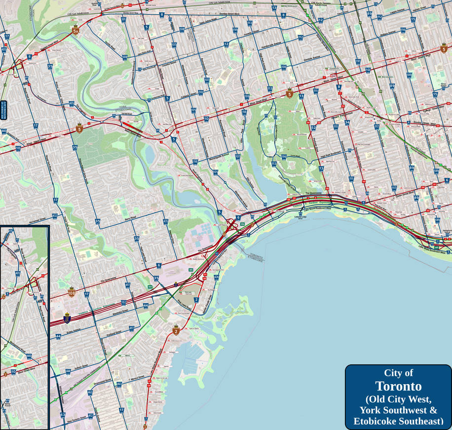
The link works I just can't figure out what the map is depicting. Looks like a road network to me, cannot see the transit lines you mentioned in the post.Toronto (Old Toronto West) (Fantasy Map) by Pyeknu on DeviantArt
www.deviantart.com
Welcome! Nice Map.I just finished work on this map of the western sector of old Toronto with southeast Etobicoke and southwest York, showing what I'd think would be a good public transit network for this part of the whole city: https://www.deviantart.com/pyeknu/art/Toronto-Old-Toronto-West-Fantasy-Map-949732811
Since I began noting all this talk of extending Line 3/the Ontario Line west of Exhibition, I thought about it and came up with the potential route that I spoke of in a previous comment on this thread:
1) Head west along the Oakville Subdivision from Exhibition to the top of the hump on the Queensway midway between South Kingsway and Parkside Drive;
2) Arc northwest to line up on South Kingsway to bring Line 3 alongside Line 2 at Old Mill station;
3) Push line three to roughly follow the Kingsway past Old Mill to cross the Dundas Street/Royal York Road intersection in old Humbertown;
4) Arc Line 3 westward on the line of Rathburn Road (to be depicted on a map of the central part of Etobicoke soon to come) past the 427 corridor, then swing north on the line of Renforth Drive; and
5) Head north along Renforth to Eglinton Avenue West and Line 5 (plus a future LRT conversion of the Mississauga Transitway), then follow the arc of Silver Dart Drive to link up with the UP Express at Pearson Terminal 1.
I chose this path since we have three subway/LRT lines going east-west in Etobicoke (Line 2 on the Bloor/Dundas corridor,, Line 5 on the Eglinton corridor and Line 6 on the Finch/Highway 27 corridor) with nothing connecting all three. Given that current plans for Line 5 West say that the LRT would do a hard turn north at Renforth Station to go into the airport ground (which will require an either very tight turn or a long looping turn to get across the 401 corridor), it made more sense to me to have another line go into the airport grounds in lieu of doing that tight of a turn with Line 5.
Of course, I'm not ignoring the possibilities with Line 2, of course. In my Etobicoke South map here (https://www.deviantart.com/pyeknu/art/Toronto-Etobicoke-South-Fantasy-Map-948871023), I have that line arc south once past the 427 corridor to link down past Sherway Gardens to Long Branch GO to eventually link up to the McCallon LRT on Hurontario (which I would mark as Peel Rapid Transit Line 1 on my maps). I also have two additional PRT lines in the Etobicoke South region; Line 4 uses the OBRY corridor from downtown Brampton through Streetsville to feed into Kipling Station while Line 6 is an upgraded Dundas BRT concept put to rails. The Mississauga Transitway, BTW, will be PRT Line 2 once I do the Etobicoke Centre map.
Since traffic might not demand a more centralized Etobicoke north-south subway/LRT (and since the Jane LRT would be implemented as TTC Line 8), the best answer to that would be a streetcar line on the Kipling Avenue arc from said station on Line 2 north to Line 6. You'll see I extended Line 512 Saint Clair past its current western terminus to link with Kipling Station on Line 2; the terminus loop serving that line and a future Kipling streetcar would appear at the very TOP of the Etobicoke South map. This would serve the Etobicoke-only major traffic on the streetcar/subway/LRT net until increased ridership may demand something more,.
Just my two toonies here...!
Welcome! Nice Map.
This sounds more like a fantasy map than Ontario line speculation.Thanks. Should have a map of central Etobicoke (covering from Kipling Station to the 409 N/S, Etobicoke Creek to Royal York Road E/W) up sometime soon. It will also contain where I plan to take Line 3 beyond Anglesea Station.
This forum is titled 'Ontario Line Extension West of Ontario Place (Speculation)'. The map they posted depicts exactly that, and fits in this thread. The forum you linked is a catch all for Toronto fantasy transit maps and rarely has detailed line routings posted in it.This sounds more like a fantasy map than Ontario line speculation.
Transit Fantasy Maps
Okay in light of new election promises concerning transit got me thinking of all the new expansion/extension projects that could be done. Here's my ideas: 1. Eglinton- elevated structure between Avenue Rd and Bayview Ave. Continues underground west to Black Creek Dr and east to Don Mills Rd...urbantoronto.ca
This forum is titled 'Ontario Line Extension West of Ontario Place (Speculation)'. The map they posted depicts exactly that, and fits in this thread. The forum you linked is a catch all for Toronto fantasy transit maps and rarely has detailed line routings posted in it.
