News   GLOBAL  |  Apr 02, 2020
 8.4K     0 
News   GLOBAL  |  Apr 01, 2020
 39K     0 
News   GLOBAL  |  Apr 01, 2020
 4.7K     0 

Hi Group,

Bow Trail - Scarcee.

Not Sure When - Yet, - 5 Years, Most Likely. Scarcee/16th Ave will Probably Get Widened to 3 Lanes Each from 16th Ave South to Bow Trail. Due to Topography, Look to See Bow Tr, Lowered to Go Under Scarcee Tr. Scarcee Goes Over on Top With Access to Bow via Top/Bottom Concepts - Somehow, That 69 KV Power Line that Comes
Up from Home Road Gets Moved Over to the Right with NEW Galvanized Poles - Really Bright, The Two 138 KV Lines Will B Reconfigured Both on the Right and Left for
Bow Tr./Scarcee, Power Station Reconfigured? Not Sure But Its a Possibility. - Act Bow Tr/Scaree Interchange,
Scarcee Stays 6 Lane Down to Richmond Road. I Believe there will B Some Reconfigurations at 17th Ave,
Those 138 KV Power Likes Stay Where They are Because They relocated when the LRT was Built. There is a Provision for Scarcee Tr Lane Widning.

Tnx
Operater,
 
Last edited:
Hi All,

Richmond Road - Scarcee Trail.

There was an Aricle in the Calgary Herald this past Summer, Stating that an Interchange of Sorts to B Bit at Richmond Rd., and Scarcee Tr. There was a Concept Design/Picture of Sorts of what the Project will Look Like. If I Understand things Right Scarcee Tr will go on the Bottom and Richmond Rd Goes on Top All the Access for Scarcee Tr will B on Top Via Controlled Traffic Lights, Just Everything moves Up as Richmond is at a Higher Elevation. As is Well Known Richmond Rd is 6b Lqnes at that Intersection and Various Turning Lanes are Two. I don't Have Access to a Site but I Believe There is at the City Roads Dept Some Ideas as to what Gets Bilt, Just Haven't Seen them as Yet.
Tnx,
Operater,
 
A good link with some pics of the SW ring road. They are from September apparently.
http://www.swcrrproject.com/media-centre/photo-gallery/


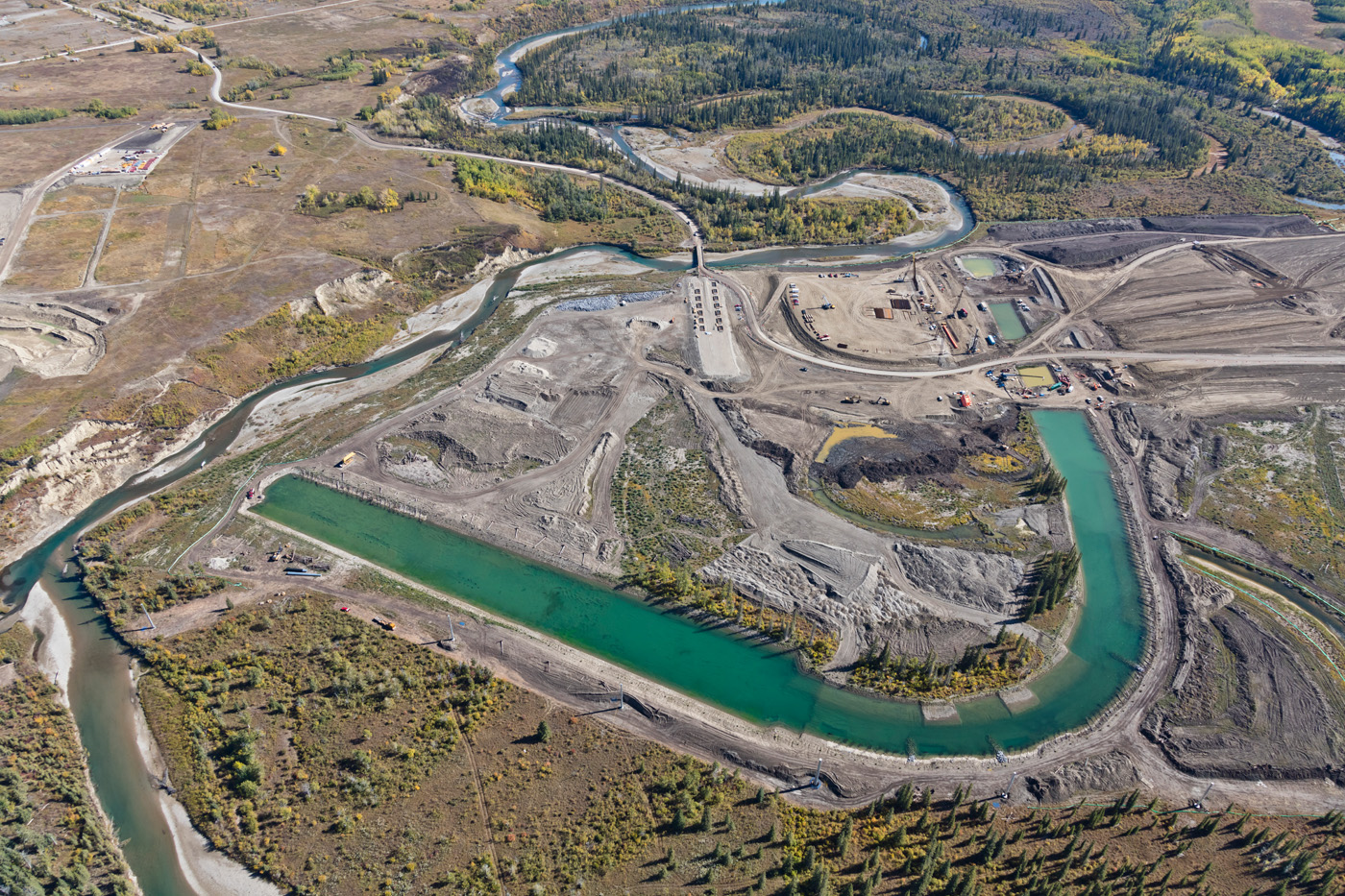
Does anyone know what this is going to be?
17-09-23-0210a.jpg
 
Are you asking what the water sections are? They are realigning the river to facilitate bridge construction and some other infrastructure.
 
Thanks!

I think the next issue that the ring road will have to face is the results of the Environmental Appeals Board hearing where the filling in of wetlands were contested. I believe that the Minister has had the report for almost a month, and that typically these kinds of reports are acted upon within 60 days. It will be interesting to see if what comes out of that, and if the news will be released over Christmas.

If it was the Board's call alone I could very well see some changes mandated to avoid the wetlands, but as this boils down to a political call, who knows what will come of it.

The interesting thing about the hearing and the current stay is that it is far more limited than most media outlets are indicating. The stay only covers 3 wetlands, not the portion of the road around the Elbow river. The map below shows the three wetlands still covered by the stay, with the red indicating what is going to be permanently filled, and the blue that will not be filled.

Looking at the map, I wonder if a small bridge over the more southern wetlands and a retaining wall along the more northern wetland would be all that would be required to proceed with the project even if changes are mandated.

Ks4NbqK.jpg
 
I've been wondering what type of changes would come about should the board rule in favor of the wetlands. If it's something that's not going to cost tons of money, maybe they'll go that route, as it would more or less appease everyone.
 
Thanks!

I think the next issue that the ring road will have to face is the results of the Environmental Appeals Board hearing where the filling in of wetlands were contested. I believe that the Minister has had the report for almost a month, and that typically these kinds of reports are acted upon within 60 days. It will be interesting to see if what comes out of that, and if the news will be released over Christmas.

If it was the Board's call alone I could very well see some changes mandated to avoid the wetlands, but as this boils down to a political call, who knows what will come of it.

The interesting thing about the hearing and the current stay is that it is far more limited than most media outlets are indicating. The stay only covers 3 wetlands, not the portion of the road around the Elbow river. The map below shows the three wetlands still covered by the stay, with the red indicating what is going to be permanently filled, and the blue that will not be filled.

Looking at the map, I wonder if a small bridge over the more southern wetlands and a retaining wall along the more northern wetland would be all that would be required to proceed with the project even if changes are mandated.

Ks4NbqK.jpg

I believe this pic has the two affected wetland areas in it. Is it just me, or do the affected areas seem quite insignificant?
17-09-23-0215a.jpg
 

Attachments

  • 17-09-23-0215a.jpg
    17-09-23-0215a.jpg
    406.4 KB · Views: 433
I can't really comment on the two that are most impacted (the ones previously on reserve land) but Wetland 6, known as the 'beaver pond' and visible in the middle of that picture above is fairly important from a bio-diversity perspective. I really hope that whatever happens, that wetland continues to be healthy and viable. It's the wetland that the main regional cyclepath crosses in that part of the Weaselhead.
 
Last edited:

Back
Top