Disparishun
Active Member
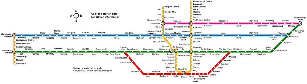
For the past few days I have been working on a schematic version of my map and I also made a few changes as well. Check it out
Doady, this is a great map, both aesthetically and -- well, once I finish puzzling it out; there's a lot to think about there -- content-wise.
I really like the way you have shown all of the transit modes on it. Did you do one using the same approach but that reflects only what is currently in place or planned (using reasonable expectations on things like Sheppard/Consumers and the Stubway Bypass LRT, I suppose) re: GO, subway, LRT? I think that would be a fantastic all-in-one-place map for people to be able to think about the system as it currently stands.